File:Lochranza (36876370013).jpg

Original file (4,912 × 7,360 pixels, file size: 23.02 MB, MIME type: image/jpeg)
Captions
Captions
Summary
[edit].jpg&action=edit§ion=1)
| Description |
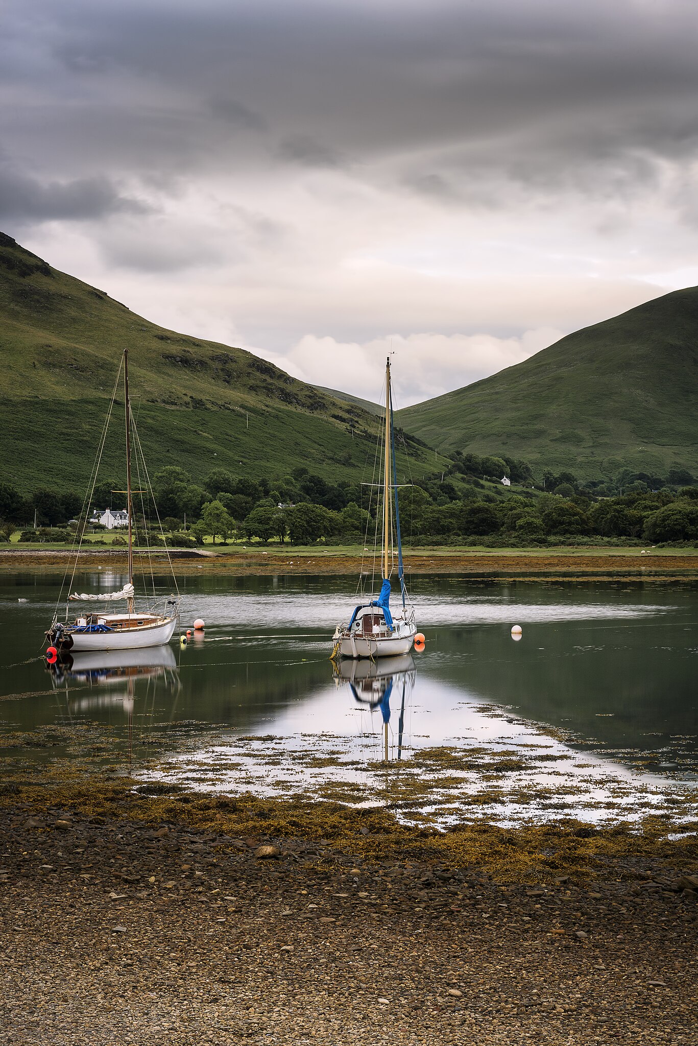
Lochranza (Scottish Gaelic: Loch Raonasa) is a village located on the Isle of Arran in the Firth of Clyde, Scotland. The population, somewhat in decline, is around 200 people. It is the most northernly sited of Arran's villages and is located in the northwestern corner of the island. The village is set on the shore of Loch Ranza, a small sea loch. Ferries run from here to Claonaig on the mainland. The village is flanked to the northeast by the landmark hill Torr Meadhonach. Formerly a herring fishing port, the village economy is now geared more towards tourism after the reopening of the pier in 2003. Lochranza Castle is a fine ruin of a 16th-century L-plan castle, across the road from the Lochranza youth hostel. Lochranza is the site of the Arran Distillery, built in 1995 and producing the Arran Single Malt. The distillery is one of the major industries of the island. The bar of the Lochranza Hotel, to the north of the distillery, has one of the largest collections of Scotch whisky available by the measure in the country: over 350 different Scotch whiskies are available. |
| Date | Taken on 17 June 2017 20:08 |
| Source | Lochranza |
| Author | James Johnstone from Ecclefechan, Scotland |
| Camera location | | View this and other nearby images on: OpenStreetMap |
|---|
.jpg¶ms=055.705119_N_-005.291234_E_globe:Earth_type:camera_source:Flickr_&language=en)
Licensing
[edit].jpg&action=edit§ion=2)
- You are free:
- to share – to copy, distribute and transmit the work
- to remix – to adapt the work
- Under the following conditions:
- attribution – You must give appropriate credit, provide a link to the license, and indicate if changes were made. You may do so in any reasonable manner, but not in any way that suggests the licensor endorses you or your use.
| This image was originally posted to Flickr by TrotterFechan at https://flickr.com/photos/89786933@N02/36876370013. It was reviewed on 16 August 2023 by FlickreviewR 2 and was confirmed to be licensed under the terms of the cc-by-2.0. |
File history
Click on a date/time to view the file as it appeared at that time.
| Date/Time | Thumbnail | Dimensions | User | Comment | |
|---|---|---|---|---|---|
| current | 20:22, 16 August 2023 | | 4,912 × 7,360 (23.02 MB) | Юрий Д.К. (talk | contribs) | Transferred from Flickr via #flickr2commons |
You cannot overwrite this file.
File usage on Commons
There are no pages that use this file.
.jpg&oldid=883085037)