File:Lochau-Pfaender-Pfaendedohle-Dohle Lift-R Lau 238243-40737.jpg
Jump to navigation
Jump to search

Size of this preview: 800 × 591 pixels. Other resolutions: 320 × 236 pixels | 640 × 473 pixels | 1,024 × 756 pixels | 1,280 × 945 pixels | 1,908 × 1,409 pixels.
Original file (1,908 × 1,409 pixels, file size: 397 KB, MIME type: image/jpeg)
Captions
Captions
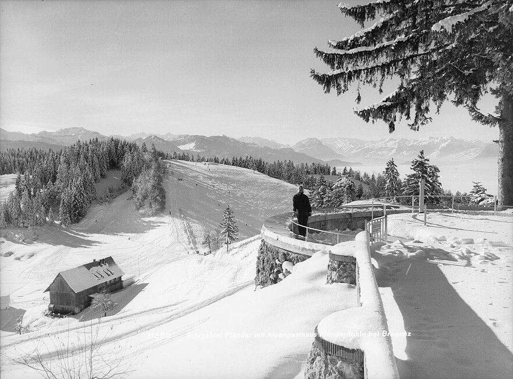
Pfaender ski area, with the Dohle slope and the Pfaenderdohle restaurant in Vorarlberg, Austria
Summary
[edit]
| Description |
Deutsch: Skigebiet Pfänder, mit dem Dohle-Hang und dem Restaurant Pfänderdohle in Vorarlberg, Österreich. Im Hintergrund: Salzbödenkopf, Hohe Matona, Hoher Freschen, Staufen, Schuttannen, Schöner Mann, Schwarzenberg, Hohe Kugel, Kapf, Rhaetikon, Schesaplana, Panüler, Grauspitzen, Galinakopf, Zigerberg, Saminatal, Drei-Schwesterngruppe, Glarner Alpen, Pizol, Balfrieser Berge, Gauschla, Alvier, Krummenstein, Gärtliköpfe, Fulfirst, Sichli, Gamsberg, Sichelkamm, Höchst, Nideri
Quelle: https://pid.volare.vorarlberg.at/o:10239 ("Foto: Sammlung Risch-Lau, Vorarlberger Landesbibliothek").
English: Pfaender ski area, with the Dohle slope and the Pfaenderdohle restaurant in Vorarlberg, Austria. Source: In the background: Salzboedenkopf, Hohe Matona, Hoher Freschen, Staufen, Schuttannen, Schoener Mann, Schwarzenberg, Hohe Kugel, Kapf, Rhaetikon, Schesaplana, Panueler, Grauspitzen, Galinakopf, Zigerberg, Saminatal, Drei-Schwesterngruppe, Glarner Alpen, Pizol, Balfrieser Berge, Gauschla, Alvier, Krummenstein, Gaertlikoepfe, Fulfirst, Sichli, Gamsberg, Sichelkamm, Hoechst, Nideri
https://pid.volare.vorarlberg.at/o:10239 ("Photo: Risch-Lau Collection, Vorarlberg State Library").
Français : Domaine skiable de Pfänder, avec la piste de Dohle et le restaurant Pfänderdohle dans le Vorarlberg, Autriche. En arrière-plan: Salzbödenkopf, Hohe Matona, Hoher Freschen, Staufen, Schuttannen, Schöner Mann, Schwarzenberg, Hohe Kugel, Kapf, Rhaetikon, Schesaplana, Panüler, Grauspitzen, Galinakopf, Zigerberg, Saminatal, Drei-Schwesterngruppe, Glarner Alpen, Pizol, Balfrieser Berge, Gauschla, Alvier, Krummenstein, Gärtliköpfe, Fulfirst, Sichli, Gamsberg, Sichelkamm, Höchst, Nideri
Source: https://pid.volare.vorarlberg.at/o:10239 ("Photo: Collection Risch-Lau, Bibliothèque d'État du Vorarlberg"). |
| Date | Unknown date |
| Source | https://pid.volare.vorarlberg.at/o:40737 |
| Author | "Foto: Sammlung Risch-Lau, Vorarlberger Landesbibliothek" |
Licensing
[edit]
This file is licensed under the Creative Commons Attribution-Share Alike 4.0 International license.
- You are free:
- to share – to copy, distribute and transmit the work
- to remix – to adapt the work
- Under the following conditions:
- attribution – You must give appropriate credit, provide a link to the license, and indicate if changes were made. You may do so in any reasonable manner, but not in any way that suggests the licensor endorses you or your use.
- share alike – If you remix, transform, or build upon the material, you must distribute your contributions under the same or compatible license as the original.
File history
Click on a date/time to view the file as it appeared at that time.
| Date/Time | Thumbnail | Dimensions | User | Comment | |
|---|---|---|---|---|---|
| current | 08:07, 19 March 2020 | | 1,908 × 1,409 (397 KB) | Asurnipal (talk | contribs) | Uploaded a work by "Foto: Sammlung Risch-Lau, Vorarlberger Landesbibliothek" from https://pid.volare.vorarlberg.at/o:40737 with UploadWizard |
You cannot overwrite this file.
File usage on Commons
The following 4 pages use this file: