File:Location of the UPR.png
Jump to navigation
Jump to search

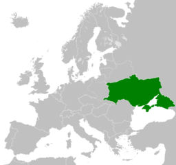
Size of this preview: 638 × 599 pixels. Other resolutions: 256 × 240 pixels | 511 × 480 pixels | 818 × 768 pixels | 1,090 × 1,024 pixels | 2,023 × 1,900 pixels.
Original file (2,023 × 1,900 pixels, file size: 337 KB, MIME type: image/png)
Captions
Captions
Location of the UPR
Summary
[edit]
| Description |
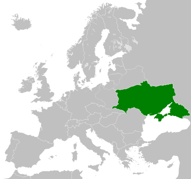
English: Map of Europe with the borders of the UPR, proclaimed by the delegation of the Ukrainian People's Republic at the Paris Peace Conference in 1919-20.
Українська: Карта Європи з кордонами УНР, проголошені делегацією Української Народної Республіки на Паризькій мирній конференції в 1919-20 роках.
Беларуская: Карта Еўропы з межамі УНР, абвешчаная дэлегацыяй Украінскай Народнай Рэспублікі на Парыжскай мірнай канферэнцыі ў 1919-20 гг.
Русский: Карта Европы с границами УНР, провозглашенные делегацией Украинской Народной Республики на Парижской мирной конференции в 1919-20 годах.
Polski: Mapa Europy z granicami URL, ogłoszona przez delegację Ukraińskiej Republiki Ludowej na Konferencji Pokojowej w Paryżu w latach 1919-20. |
| Date | |
| Source | Own work |
| Author | Witalii |
Licensing
[edit]
I, the copyright holder of this work, hereby publish it under the following license:
This file is licensed under the Creative Commons Attribution-Share Alike 4.0 International license.
- You are free:
- to share – to copy, distribute and transmit the work
- to remix – to adapt the work
- Under the following conditions:
- attribution – You must give appropriate credit, provide a link to the license, and indicate if changes were made. You may do so in any reasonable manner, but not in any way that suggests the licensor endorses you or your use.
- share alike – If you remix, transform, or build upon the material, you must distribute your contributions under the same or compatible license as the original.
File history
Click on a date/time to view the file as it appeared at that time.
| Date/Time | Thumbnail | Dimensions | User | Comment | |
|---|---|---|---|---|---|
| current | 13:57, 17 January 2021 | | 2,023 × 1,900 (337 KB) | Super Dromaeosaurus (talk | contribs) | Ukraine never controlled any part of Bukovina or Bessarabia |
| 17:57, 3 September 2020 |  | 2,023 × 1,900 (435 KB) | Jafaz (talk | contribs) | Uploaded own work with UploadWizard |
You cannot overwrite this file.
File usage on Commons
The following page uses this file:
File usage on other wikis
The following other wikis use this file:
- Usage on az.wikipedia.org
- Usage on be-tarask.wikipedia.org
- Usage on bg.wikipedia.org
- Usage on ca.wikipedia.org
- Usage on cs.wikipedia.org
- Usage on cy.wikipedia.org
- Usage on da.wikipedia.org
- Usage on de.wikipedia.org
- Usage on el.wikipedia.org
- Usage on eu.wikipedia.org
- Usage on fa.wikipedia.org
- Usage on fi.wikipedia.org
- Usage on gl.wikipedia.org
- Usage on he.wikipedia.org
- Usage on hy.wikipedia.org
- Usage on id.wikipedia.org
- Usage on incubator.wikimedia.org
- Usage on ja.wikipedia.org
- Usage on ko.wikipedia.org
- Usage on pnb.wikipedia.org
- Usage on ro.wikipedia.org
- Usage on sh.wikipedia.org
- Usage on sr.wikipedia.org
- Usage on sv.wikipedia.org
- Usage on www.wikidata.org