File:Location of Temurmalik District in Tajikistan.png
Jump to navigation
Jump to search

Size of this preview: 800 × 512 pixels. Other resolutions: 320 × 205 pixels | 640 × 410 pixels | 1,024 × 656 pixels | 1,280 × 819 pixels | 1,601 × 1,025 pixels.
Original file (1,601 × 1,025 pixels, file size: 69 KB, MIME type: image/png)
Captions
Captions
Add a one-line explanation of what this file represents
| Description |
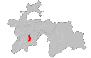
English: Location of Temurmalik District in Tajikistan
Русский: Расположение Темурмаликского района в Таджикистане
Українська: Розташування Темурмаліцього району в Таджикистані |
| Date | |
| Source | Tajikistan_districts.png (authors: Rarelibra, Ahonc) |
| Author | Anatoliy Honcharov |
| Permission (Reusing this file) |
Attribution ShareAlike 3.0 |
This file is licensed under the Creative Commons Attribution-Share Alike 3.0 Unported license.
- You are free:
- to share – to copy, distribute and transmit the work
- to remix – to adapt the work
- Under the following conditions:
- attribution – You must give appropriate credit, provide a link to the license, and indicate if changes were made. You may do so in any reasonable manner, but not in any way that suggests the licensor endorses you or your use.
- share alike – If you remix, transform, or build upon the material, you must distribute your contributions under the same or compatible license as the original.
File history
Click on a date/time to view the file as it appeared at that time.
| Date/Time | Thumbnail | Dimensions | User | Comment | |
|---|---|---|---|---|---|
| current | 12:56, 1 February 2017 | | 1,601 × 1,025 (69 KB) | Вальдимар (talk | contribs) | уточнення |
| 11:56, 13 February 2009 |  | 1,601 × 1,025 (36 KB) | Ahonc (talk | contribs) | {{Information |Description={{En|Location of Temurmalik District in Tajikistan}} {{Ru|Расположение Темурмаликского района в Таджикистане}} {{Uk|Розташування Темурмаліцього району |
You cannot overwrite this file.
File usage on Commons
The following 2 pages use this file:
File usage on other wikis
The following other wikis use this file:
- Usage on ce.wikipedia.org
- Usage on en.wikipedia.org
- Usage on fa.wikipedia.org
- Usage on it.wikipedia.org
- Usage on kaa.wikipedia.org
- Usage on pnb.wikipedia.org
- Usage on ru.wikipedia.org
- Usage on tg.wikipedia.org
- Деҳоти Ҳусайнобод
- Деҳоти Кангурт
- Деҳоти Чилчаҳ
- Деҳоти Танобчӣ
- Ноҳияи Темурмалик
- Деҳоти Саидмуъмин Раҳимов
- Деҳоти Кушктеппа
- Шаблон:Ноҳияи Темурмалик
- Баҳористон (деҳа, н. Темурмалик)
- Ваҳдат (деҳа, н. Темурмалик)
- Гулистон (деҳа, н. Темурмалик)
- Гулобод (деҳа, н. Темурмалик)
- Давлатҳалқаёр
- Иттифоқ (деҳа, н. Темурмалик)
- Лолазор (деҳа, н. Темурмалик)
- Меҳнатобод (деҳа, н. Темурмалик)
- Олмабулоқ
- Офтобрӯя (деҳа, н. Темурмалик)
- Чилча
- Шибонай
- Шириноб (деҳа, н. Темурмалик)
- Яккасада (деҳа, н. Темурмалик)
- Гузари Тор
- Давлатшоён
- Зарнисор (деҳа, н. Темурмалик)
- Кангурт
- Обиширин
- Савда (деҳа, н. Темурмалик)
- Сафарбоён
- Чаврок
- Чалишиён
- Чашмасор (деҳа, н. Темурмалик)
- Бӯстон (деҳа, н. Темурмалик)
- Гулдоман
- Даҳанинамак
- Дӯстӣ (деҳа, н. Темурмалик)
- Фалҳобод
- Чинор (деҳа, н. Темурмалик)
- Бахтнома (деҳа, н. Темурмалик)
- Бачамазор
- Боғи Темур
- Булбулон
- Ғурулдӣ
View more global usage of this file.