File:Location of Completed Portions of the National System of Interstate and Defense Highways as of June 30, 1957.png
Jump to navigation
Jump to search

Size of this preview: 800 × 504 pixels. Other resolutions: 320 × 201 pixels | 640 × 403 pixels | 1,024 × 645 pixels | 1,280 × 806 pixels | 2,075 × 1,306 pixels.
Original file (2,075 × 1,306 pixels, file size: 1.69 MB, MIME type: image/png)
Captions
Captions
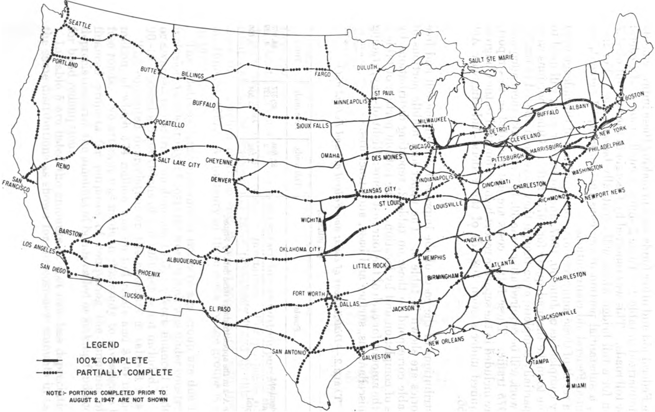
Location of Completed Portions of the National System of Interstate and Defense Highways as of June 30, 1957
Summary
[edit]
| Description |
English: Map showing Location of Completed Portions of the National System of Interstate and Defense Highways as of June 30, 1957 |
| Date | |
| Source | Consideration for Reimbursement for Certain Highways on the Interstate System |
| Author | Bureau of Public Roads |
Licensing
[edit]
This work is in the public domain in the United States because it is a work prepared by an officer or employee of the United States Government as part of that person’s official duties under the terms of Title 17, Chapter 1, Section 105 of the US Code.
Note: This only applies to original works of the Federal Government and not to the work of any individual U.S. state, territory, commonwealth, county, municipality, or any other subdivision. This template also does not apply to postage stamp designs published by the United States Postal Service since 1978. (See § 313.6(C)(1) of Compendium of U.S. Copyright Office Practices). It also does not apply to certain US coins; see The US Mint Terms of Use.
|
 | |
| This file has been identified as being free of known restrictions under copyright law, including all related and neighboring rights. | ||
File history
Click on a date/time to view the file as it appeared at that time.
| Date/Time | Thumbnail | Dimensions | User | Comment | |
|---|---|---|---|---|---|
| current | 16:42, 2 June 2022 | | 2,075 × 1,306 (1.69 MB) | Imzadi1979 (talk | contribs) | Uploaded a work by Bureau of Public Roads from ''Consideration for Reimbursement for Certain Highways on the Interstate System'' with UploadWizard |
You cannot overwrite this file.
File usage on Commons
The following 2 pages use this file:
File usage on other wikis
The following other wikis use this file: