File:Location map of North Mountains of Guadalajara Natural Park.jpg
Jump to navigation
Jump to search

Size of this preview: 800 × 566 pixels. Other resolutions: 320 × 226 pixels | 640 × 452 pixels | 812 × 574 pixels.
Original file (812 × 574 pixels, file size: 315 KB, MIME type: image/jpeg)
Captions
Captions
Add a one-line explanation of what this file represents
| Description |
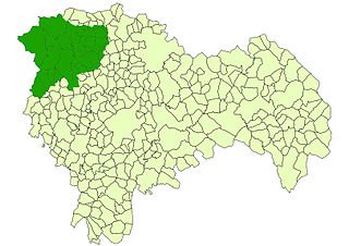
Español: Localización del Parque Natural de la Sierra Norte de Guadalajara (España) English: Location map of North Mountains of Guadalajara Natural Park, in Spain. 2003 |
| Date | (UTC) |
| Source | |
| Author | Sonsaz (talk) |
| This is a retouched picture, which means that it has been digitally altered from its original version. The original can be viewed here: Guadalaja - Mapa municipal.svg:
|
I, the copyright holder of this work, hereby publish it under the following licenses:
| This file is licensed under the Creative Commons Attribution-Share Alike 3.0 Unported license. | ||
| ||
| This licensing tag was added to this file as part of the GFDL licensing update. |

|
Permission is granted to copy, distribute and/or modify this document under the terms of the GNU Free Documentation License, Version 1.2 or any later version published by the Free Software Foundation; with no Invariant Sections, no Front-Cover Texts, and no Back-Cover Texts. A copy of the license is included in the section entitled GNU Free Documentation License. |
You may select the license of your choice.
Original upload log
[edit]
This image is a derivative work of the following images:
- File:Guadalaja_-_Mapa_municipal.svg licensed with Cc-by-sa-3.0-migrated, GFDL
- 2005-10-29T13:09:52Z Tony Rotondas 778x413 (518037 Bytes) '''Title''' :'''es:''' Municipios de Guadalajara (España). 2003 :'''en:''' Municipalities of Guadalajara (Spain). 2003 '''Author''' :[http://es.wikipedia.org/wiki/Usuario:Tony_Rotondas Emilio Gómez Fernández] {{GFDL}} [[
Uploaded with derivativeFX
File history
Click on a date/time to view the file as it appeared at that time.
| Date/Time | Thumbnail | Dimensions | User | Comment | |
|---|---|---|---|---|---|
| current | 15:34, 29 May 2011 | | 812 × 574 (315 KB) | Sonsaz (talk | contribs) | {{Information:'''es:''' Localización del Parque Natural de la Sierra Norte de Guadalajara (España):'''en:''' Location map of North Mountains of Guadalajara Natural Park, in Spain. 2003 '''Author''' :User:Sonsaz |Source=*[[:File:Guadalaja_-_Mapa_mun |
You cannot overwrite this file.
File usage on Commons
There are no pages that use this file.
File usage on other wikis
The following other wikis use this file:
- Usage on es.wikipedia.org