File:Location map Northeastern San Diego.png
Jump to navigation
Jump to search

Size of this preview: 632 × 600 pixels. Other resolutions: 253 × 240 pixels | 506 × 480 pixels | 689 × 654 pixels.
Original file (689 × 654 pixels, file size: 324 KB, MIME type: image/png)
Captions
Captions
Add a one-line explanation of what this file represents
| Description |
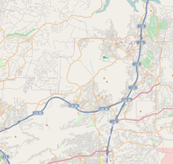
This map of Northeastern San Diego was created from OpenStreetMap project data, collected by the community. This map may be incomplete, and may contain errors. Don't rely solely on it for navigation. |
|||||||||
| Date | (see file history) | |||||||||
| Source | openstreetmap.org | |||||||||
| Creator |
OpenStreetMap contributors |
|||||||||
| Permission (Reusing this file) |
OpenStreetMap data and maps are licensed under the Creative Commons Attribution-ShareAlike 2.0 license (CC-BY-SA 2.0). This file is licensed under the Creative Commons Attribution-Share Alike 2.0 Generic license.
|
|||||||||
| Geotemporal data | ||||||||||
| Bounding box |
|
|||||||||
| Georeferencing | If inappropriate please set warp_status = skip to hide. | |||||||||
File history
Click on a date/time to view the file as it appeared at that time.
| Date/Time | Thumbnail | Dimensions | User | Comment | |
|---|---|---|---|---|---|
| current | 06:17, 12 October 2010 | | 689 × 654 (324 KB) | Zzyzx11 (talk | contribs) | {{OpenStreetMap |location=Northeastern San Diego |top=33.0573 |bottom=32.9053 |left=-117.2345 |right=-117.0436 }} Category:OpenStreetMap maps of the United States |
You cannot overwrite this file.
File usage on Commons
There are no pages that use this file.
File usage on other wikis
The following other wikis use this file:
- Usage on ar.wikipedia.org
- Usage on ceb.wikipedia.org
- Usage on en.wikipedia.org
- Carmel Valley, San Diego
- Rancho Bernardo, San Diego
- Rancho Peñasquitos, San Diego
- Black Mountain Ranch, San Diego
- Carmel Mountain Ranch, San Diego
- Sabre Springs, San Diego
- Torrey Highlands, San Diego
- Del Mar Mesa, San Diego
- Pacific Highlands Ranch, San Diego
- Module:Location map/data/United States San Diego Northeastern/doc
- Fairway Village
- Module:Location map/data/United States San Diego Northeastern
- Usage on fa.wikipedia.org
- Usage on kn.wikipedia.org
- Usage on si.wikipedia.org
- Usage on tr.wikipedia.org
- Usage on uz.wikipedia.org
- Usage on war.wikipedia.org