File:Location map Bonaire.png
Jump to navigation
Jump to search

Size of this preview: 568 × 600 pixels. Other resolutions: 227 × 240 pixels | 455 × 480 pixels | 739 × 780 pixels.
Original file (739 × 780 pixels, file size: 140 KB, MIME type: image/png)
Captions
Captions
Add a one-line explanation of what this file represents
| Description |
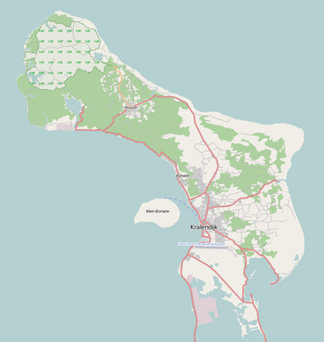
English: Map of Bonaire for pin
Geographic limits of the map:
This file is licensed under the Creative Commons Attribution-Share Alike 2.0 Generic license.
|
| Date | |
| Source | Maps for free |
| Author | Dr. Blofeld |
File history
Click on a date/time to view the file as it appeared at that time.
| Date/Time | Thumbnail | Dimensions | User | Comment | |
|---|---|---|---|---|---|
| current | 10:58, 2 May 2011 | | 739 × 780 (140 KB) | Blofeld Dr. (talk | contribs) | {{Information |Description ={{en|1=t}} |Source =t |Author =t |Date =t |Permission = |other_versions = }} |
You cannot overwrite this file.
File usage on Commons
There are no pages that use this file.
File usage on other wikis
The following other wikis use this file:
- Usage on ar.wikipedia.org
- Usage on bg.wikipedia.org
- Usage on bs.wikipedia.org
- Usage on ceb.wikipedia.org
- Plantilya:Location map Bonaire
- Signal Hill
- Green Island
- Flat Point
- Castle Hill
- North Point
- Little Island
- Sugar Loaf
- Southeast Point
- Santa Maria (pagklaro)
- Angola (pagklaro)
- Camia (pagklaro)
- Pig Rock
- Montana
- Lac
- Rincón
- Peak Hill
- Kates Hill
- Fort Hill
- Tent Point
- Little Mountain
- Grey Hill
- Needle Rocks
- Pilot Hill
- Bunker Hill
- Ceru Pretu
- Oranjestad
- Westpunt
- Ceru Grandi
- Seroe Grandi
- Well’s Gut
- Wash Gut
- Hellsgate
- Troy
- The Bottom
- Soledad
- Soldiers Gut
- Smith Gut
- Sint Eustatius
- Saint John’s Hill
- Saba Island
- Saba (pagklaro)
- Rancho
- Pisga
- Paris Hill
- Montaña
View more global usage of this file.