File:Location-map-upernavik-archipelago.png
Jump to navigation
Jump to search

Size of this preview: 232 × 598 pixels. Other resolution: 300 × 773 pixels.
Original file (300 × 773 pixels, file size: 114 KB, MIME type: image/png)
Captions
Captions
Add a one-line explanation of what this file represents
Summary
[edit]
| Description |
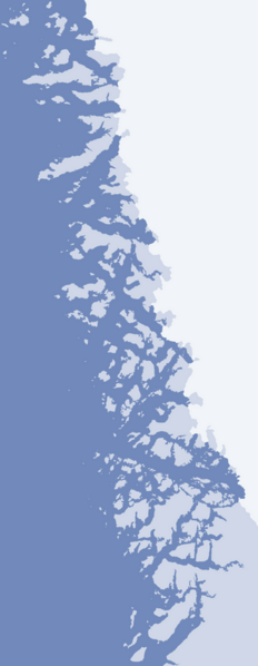
Location map of the Upernavik Archipelago. The geographical limits of the map:
|
| Date | |
| Source | OpenStreetMap |
| Author | Algkalv (talk) |
Licensing
[edit]
I, the copyright holder of this work, hereby publish it under the following license:
This file is licensed under the Creative Commons Attribution-Share Alike 3.0 Unported license.
- You are free:
- to share – to copy, distribute and transmit the work
- to remix – to adapt the work
- Under the following conditions:
- attribution – You must give appropriate credit, provide a link to the license, and indicate if changes were made. You may do so in any reasonable manner, but not in any way that suggests the licensor endorses you or your use.
- share alike – If you remix, transform, or build upon the material, you must distribute your contributions under the same or compatible license as the original.
File history
Click on a date/time to view the file as it appeared at that time.
| Date/Time | Thumbnail | Dimensions | User | Comment | |
|---|---|---|---|---|---|
| current | 14:23, 17 August 2010 | 300 × 773 (114 KB) | Algkalv (talk | contribs) | {{Information |Description=Upernavik Archipelago. Geographic limits of the map: * N: 74.8027778 * S: 72.05 * W: -57.85 * E: -54.083 |Source=OpenStreetMap |Date=2010-08-17 |Author= Algkalv ([[User talk:Algkalv|<span |
You cannot overwrite this file.
File usage on Commons
There are no pages that use this file.
File usage on other wikis
The following other wikis use this file:
- Usage on ar.wikipedia.org
- Usage on ceb.wikipedia.org
- Usage on cs.wikipedia.org
- Usage on en.wikipedia.org
- Nutaarmiut Island
- Nuussuaq Peninsula (Upernavik Archipelago)
- Umiasussuk
- Module:Location map/data/Greenland Upernavik Archipelago/doc
- Wilcox Head
- Inussulik Bay
- Illullip Sermia
- Sanningassorsuaq Peninsula
- Ikerasaa Strait
- Alison Bay
- Sandersons Hope
- Amitsorsuaq Island
- Torsukattak Strait (Upernavik Archipelago)
- Sugar Loaf Bay
- Wandel Land
- Devil's Thumb (Greenland)
- Nunatarsuaq
- Nunatakassak
- Nunatakassaup Sermia
- Cornell Glacier
- Nuussuup Kangia
- Anoritooq
- Orsugissap Qaqqarsua
- Illulissuaq Peninsula
- Saqqarlersuup Sullua
- Tasiusaq Bay
- Kangerluarsuk Fjord
- Ikermiorsuaq Island
- Nasaussap Saqqaa
- Giesecke Glacier
- Kangerlussuaq Icefjord
- Nunatarsuaq (Tasiusaq Bay)
- Nunatakassaup Sermia (Tasiusaq Bay)
- Alanngorsuup Sermia
- Upernavik Glacier
- Upernavik Icefjord
- Appaalissiorfiup Ikerasaa
- Cape Shackleton
- Ikerasak Strait
- Simiuttap Ikerasaa
- Nuussuup Nuua
- Qassersuaq Peninsula
- Kangerlussuaq Fjord (Kangeq Peninsula)
- Maniitsoq Island (Upernavik Archipelago)
- Qeqertaq Island
- Qeqertarsuaq Island (Upernavik Icefjord)
- Kangeq Peninsula
View more global usage of this file.