File:Localisation-Kumano-Prefecture de Mie.png
Jump to navigation
Jump to search

Size of this preview: 653 × 600 pixels. Other resolutions: 261 × 240 pixels | 523 × 480 pixels | 981 × 901 pixels.
Original file (981 × 901 pixels, file size: 40 KB, MIME type: image/png)
Captions
Captions
Add a one-line explanation of what this file represents
Summary
[edit]
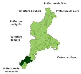
| Description | Localisation de la ville de Kumano (Japon) dans la préfectre de Mie. |
| Date | |
| Source | Image:MieMapCurrent.png |
| Author | user:Duarna |
| Permission (Reusing this file) |
PD |
Licensing
[edit]
| I, the copyright holder of this work, release this work into the public domain. This applies worldwide. In some countries this may not be legally possible; if so: I grant anyone the right to use this work for any purpose, without any conditions, unless such conditions are required by law. |
File history
Click on a date/time to view the file as it appeared at that time.
| Date/Time | Thumbnail | Dimensions | User | Comment | |
|---|---|---|---|---|---|
| current | 13:07, 19 December 2007 | | 981 × 901 (40 KB) | Duarna (talk | contribs) | {{Information |Description=Localisation de la ville de Kumano (Japon) dans la préfectre de Mie. |Source=Image:MieMapCurrent.png |Date=19/12/2007 |Author=user:Duarna |Permission=PD |other_versions= }} |
You cannot overwrite this file.
File usage on Commons
There are no pages that use this file.