File:Litomyšlské motocyklové závody - trasy.svg
Jump to navigation
Jump to search

Size of this PNG preview of this SVG file: 800 × 455 pixels. Other resolutions: 320 × 182 pixels | 640 × 364 pixels | 1,024 × 583 pixels | 1,280 × 729 pixels | 2,560 × 1,458 pixels | 1,665 × 948 pixels.
Original file (SVG file, nominally 1,665 × 948 pixels, file size: 1.34 MB)
Captions
Captions
Add a one-line explanation of what this file represents
Summary
[edit]
| Description |
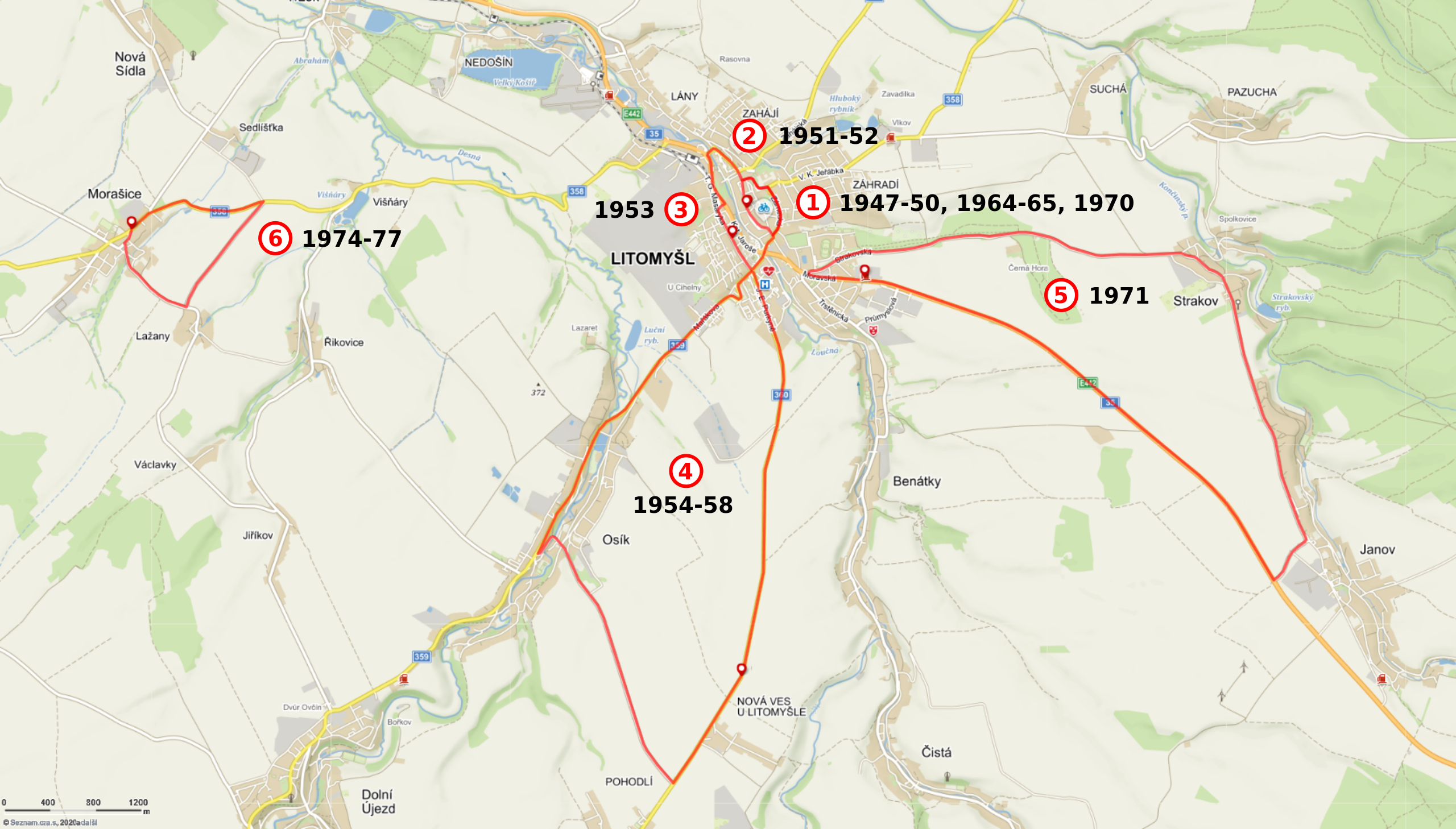
Čeština: Hrubý zákres různých závodních okruhů v průběhu let 1947-1977. Hlavní článek: Litomyšlské motocyklové závody. (Trasy jsou zakreslené jen přibližně na základě slovního popisu nebo nákresů. Nezohledňují např. změnu vedení silnic a ulic oproti současnému stavu mapového podkladu. Konkrétně jsou autorovi obrázku známy přinejmenším dva případy: 1) Dnešní ulice T. G. Masaryka v Litomyšli v době závodů patrně plynule navazovala na dnešní ulici Kpt. Jaroše poblíž Smetanova domu, takže by tam neměl být ten viditelný "zub". 2) Písemné prameny uvedené v článku o závodech na české Wikipedii zmiňují, že mezi Osíkem a Litomyšlí byly v době závodů serpentiny, později patrně nahrazené rovnou silnicí.) |
| Date | |
| Source | Mapy.cz |
| Author |
Mapový podklad a grafika tras: © Seznam.cz, a.s. Zakreslení tras a popisky: Bazi |
| SVG development |
Licensing
[edit]
This file is licensed under the Creative Commons Attribution-Share Alike 4.0 International license.
- You are free:
- to share – to copy, distribute and transmit the work
- to remix – to adapt the work
- Under the following conditions:
- attribution – You must give appropriate credit, provide a link to the license, and indicate if changes were made. You may do so in any reasonable manner, but not in any way that suggests the licensor endorses you or your use.
- share alike – If you remix, transform, or build upon the material, you must distribute your contributions under the same or compatible license as the original.
File history
Click on a date/time to view the file as it appeared at that time.
| Date/Time | Thumbnail | Dimensions | User | Comment | |
|---|---|---|---|---|---|
| current | 16:20, 21 December 2020 | | 1,665 × 948 (1.34 MB) | Bazi (talk | contribs) | Uploaded a work by Mapový podklad a grafika tras: © Seznam.cz, a.s. Zakreslení tras a popisky: Bazi from Mapy.cz with UploadWizard |
You cannot overwrite this file.
File usage on Commons
The following 2 pages use this file:
File usage on other wikis
The following other wikis use this file:
- Usage on cs.wikipedia.org
- Usage on www.wikidata.org