File:Linemap of West Japan Railway Company Osakahigashi Line.PNG
Jump to navigation
Jump to search

Size of this preview: 799 × 259 pixels. Other resolutions: 320 × 104 pixels | 1,200 × 389 pixels.
Original file (1,200 × 389 pixels, file size: 205 KB, MIME type: image/png)
Captions
Captions
Add a one-line explanation of what this file represents
Summary
[edit]| Description |
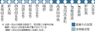
日本語: おおさか東線の路線図(未開業区間を含む) |
| Date | |
| Source | 投稿者が制作 |
| Author | Chihayasassas |
| Other versions |
|


| I, the copyright holder of this work, release this work into the public domain. This applies worldwide. In some countries this may not be legally possible; if so: I grant anyone the right to use this work for any purpose, without any conditions, unless such conditions are required by law. |
File history
Click on a date/time to view the file as it appeared at that time.
| Date/Time | Thumbnail | Dimensions | User | Comment | |
|---|---|---|---|---|---|
| current | 19:27, 9 November 2009 | 1,200 × 389 (205 KB) | Chihayasassas (talk | contribs) | {{Information |Description={{ja|1=おおさか東線の路線図(未開業区間を含む)}} |Source=投稿者が制作 |Author=Chihayasassas |Date=2009年11月10日 |Permission= |other_versions= }} Category:鉄道路線図 |
You cannot overwrite this file.
File usage on Commons
The following 25 pages use this file:
- File:Linemap of East Japan Railway Company Hachikō Line.PNG
- File:Linemap of East Japan Railway Company Kawagoe Line.PNG
- File:Linemap of East Japan Railway Company Keihintōhoku and Negishi Line.PNG
- File:Linemap of East Japan Railway Company Keiyo Line.PNG
- File:Linemap of East Japan Railway Company Saikyo Line.PNG
- File:Linemap of East Japan Railway Company Tōkaidō Line.PNG
- File:Linemap of East Japan Railway Company Yamanote Line.PNG
- File:Linemap of East Japan Railway Company Yokohama Line.PNG
- File:Linemap of Osaka Municipal Transportation Bureau Chuo Line.PNG
- File:Linemap of Osaka Municipal Transportation Bureau Imazatosuji Line.PNG
- File:Linemap of Osaka Municipal Transportation Bureau Midosuji Line.PNG
- File:Linemap of Osaka Municipal Transportation Bureau Nagahori Tsurumi-ryokuchi Line.PNG
- File:Linemap of Osaka Municipal Transportation Bureau Nanko Port Town Line.PNG
- File:Linemap of Osaka Municipal Transportation Bureau Sakaisuji Line.PNG
- File:Linemap of Osaka Municipal Transportation Bureau Sennichimae Line.PNG
- File:Linemap of Osaka Municipal Transportation Bureau Tanimachi Line.PNG
- File:Linemap of Osaka Municipal Transportation Bureau Yotsubashi Line.PNG
- File:Linemap of TokyoMetro Ginza Line.png
- File:Linemap of TokyoMetro Marunouchi Line.png
- File:Linemap of TokyoMetro Namboku Line.PNG
- File:Linemap of Tokyo Metropolitan Government Bureau of Transportation Asakusa Line.PNG
- File:Linemap of Tokyo Metropolitan Government Bureau of Transportation Mita Line.PNG
- File:Linemap of Tokyo Metropolitan Government Bureau of Transportation Oedo Line.PNG
- File:Linemap of West Japan Railway Company Osaka loop Line.PNG
- Template:Other versions/Municipial Transportation in Japan