File:Lindenhof - Turicum - Grabstein Lucius Aelius Urbicus 2018-09-05 15-41-27.jpg
Jump to navigation
Jump to search
Size of this preview: 400 × 600 pixels. Other resolutions: 160 × 240 pixels | 320 × 480 pixels | 512 × 768 pixels | 682 × 1,024 pixels | 1,365 × 2,048 pixels | 4,000 × 6,000 pixels.
Original file (4,000 × 6,000 pixels, file size: 8.58 MB, MIME type: image/jpeg)
Captions
Captions
Add a one-line explanation of what this file represents
Summary
[edit]
| Description |
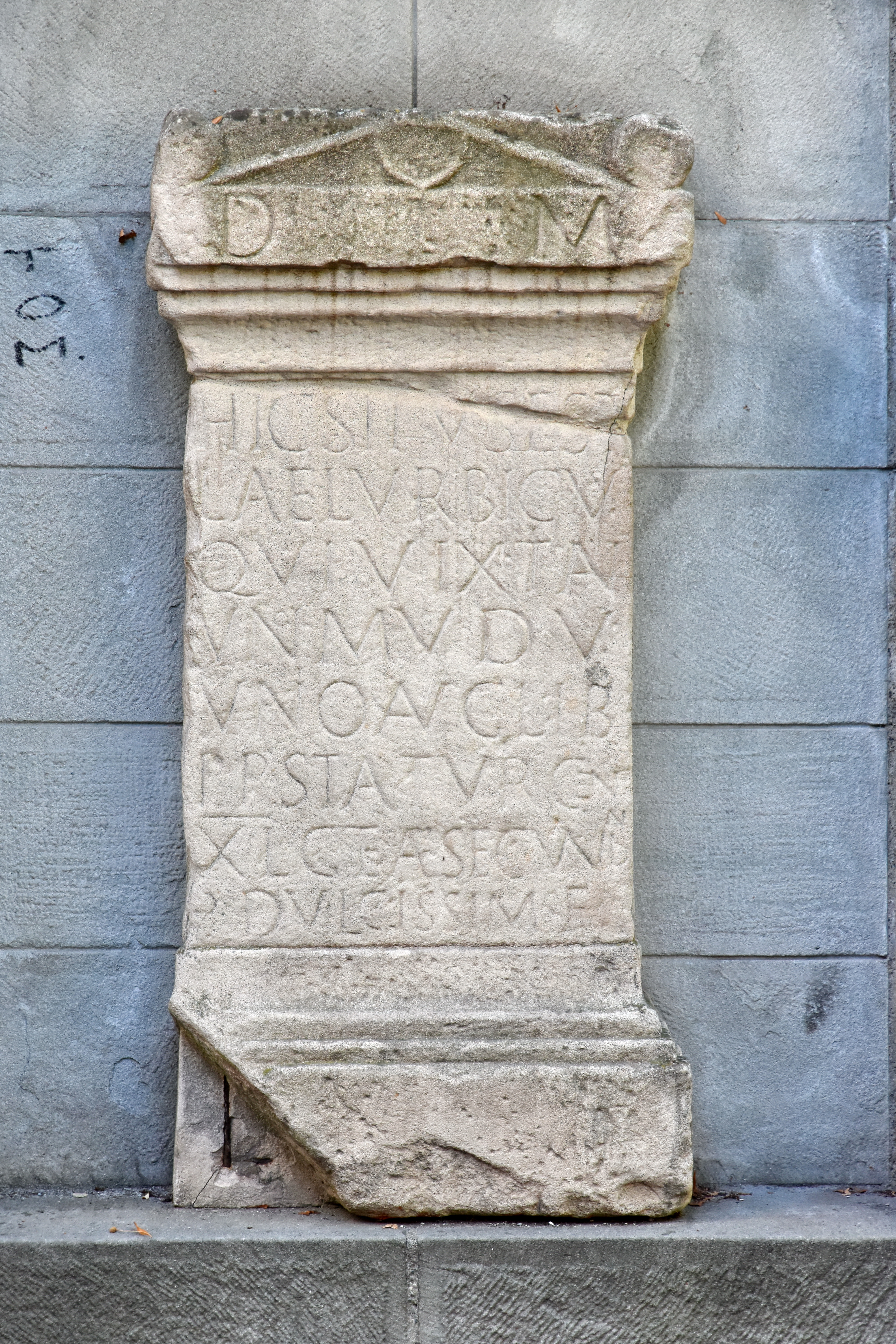
English: * English: Modern replica of an Ancient Roman gravestone along the Pfalzgasse on the Lindenhof hill in Zürich, Switzerland – the original, now in the Landesmuseum (Swiss National Museum) in Zürich, dates from 185/200 AD. It contains the first recorded mention of "Turicum" (latin name of Zurich). The gravestone was erected for Lucius Aelius Urbicus, a one-year old child, by his parents Unio, freedman of Augustus, and Aelia Secundina. Corpus Inscriptionum Latinarum, XIII 5244.
Deutsch: Epigraphische Datenbank Heidelberg. Ein weiteres Foto F023424
|
||
| Date | |||
| Source | Own work | ||
| Author | Roland zh | ||
| Attribution (required by the license) | © Roland Fischer, Zürich (Switzerland) – Mail notification to: roland_zh(at)hispeed(dot)ch / Wikimedia Commons / | ||
| Camera location | | View this and other nearby images on: OpenStreetMap |
|---|
Licensing
[edit]
I, the copyright holder of this work, hereby publish it under the following license:
This file is licensed under the Creative Commons Attribution-Share Alike 4.0 International license.
- You are free:
- to share – to copy, distribute and transmit the work
- to remix – to adapt the work
- Under the following conditions:
- attribution – You must give appropriate credit, provide a link to the license, and indicate if changes were made. You may do so in any reasonable manner, but not in any way that suggests the licensor endorses you or your use.
- share alike – If you remix, transform, or build upon the material, you must distribute your contributions under the same or compatible license as the original.

|
This image was uploaded as part of Wiki Loves Monuments 2018.
|
File history
Click on a date/time to view the file as it appeared at that time.
| Date/Time | Thumbnail | Dimensions | User | Comment | |
|---|---|---|---|---|---|
| current | 01:04, 9 September 2018 | | 4,000 × 6,000 (8.58 MB) | Roland zh (talk | contribs) | User created page with UploadWizard |
You cannot overwrite this file.
File usage on Commons
There are no pages that use this file.