File:Limoux carte de cassini 1780.jpg
Limoux_carte_de_cassini_1780.jpg (360 × 270 pixels, file size: 38 KB, MIME type: image/jpeg)
Captions
Captions
| Camera location | | View this and other nearby images on: OpenStreetMap |
|---|
| Description |
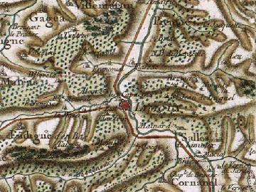
Français : Carte de Cassini de Limoux vers 1780 |
| Date | |
| Source | Site de Cassini |
| Author | Pinpin |
|
This work is in the public domain in its country of origin and other countries and areas where the copyright term is the author's life plus 70 years or fewer.
| |
| This file has been identified as being free of known restrictions under copyright law, including all related and neighboring rights. | |
File history
Click on a date/time to view the file as it appeared at that time.
| Date/Time | Thumbnail | Dimensions | User | Comment | |
|---|---|---|---|---|---|
| current | 16:59, 29 July 2007 | | 360 × 270 (38 KB) | Pinpin (talk | contribs) | {{Information |Description= {{fr}} Carte de Cassini de Limoux vers 1780 |Source= [http://cassini.ehess.fr/ Site de Cassini] |Date=2007/07/29 |Author=Pinpin |Permission=see below |other_versions= }} {{PD-old}} Category:Limoux |
You cannot overwrite this file.
File usage on Commons
There are no pages that use this file.
File usage on other wikis
The following other wikis use this file: