File:Lime Rock Park.svg
Jump to navigation
Jump to search

Size of this PNG preview of this SVG file: 619 × 415 pixels. Other resolutions: 320 × 215 pixels | 640 × 429 pixels | 1,024 × 687 pixels | 1,280 × 858 pixels | 2,560 × 1,716 pixels.
Original file (SVG file, nominally 619 × 415 pixels, file size: 459 KB)
Captions
Captions
Add a one-line explanation of what this file represents
Summary
[edit]
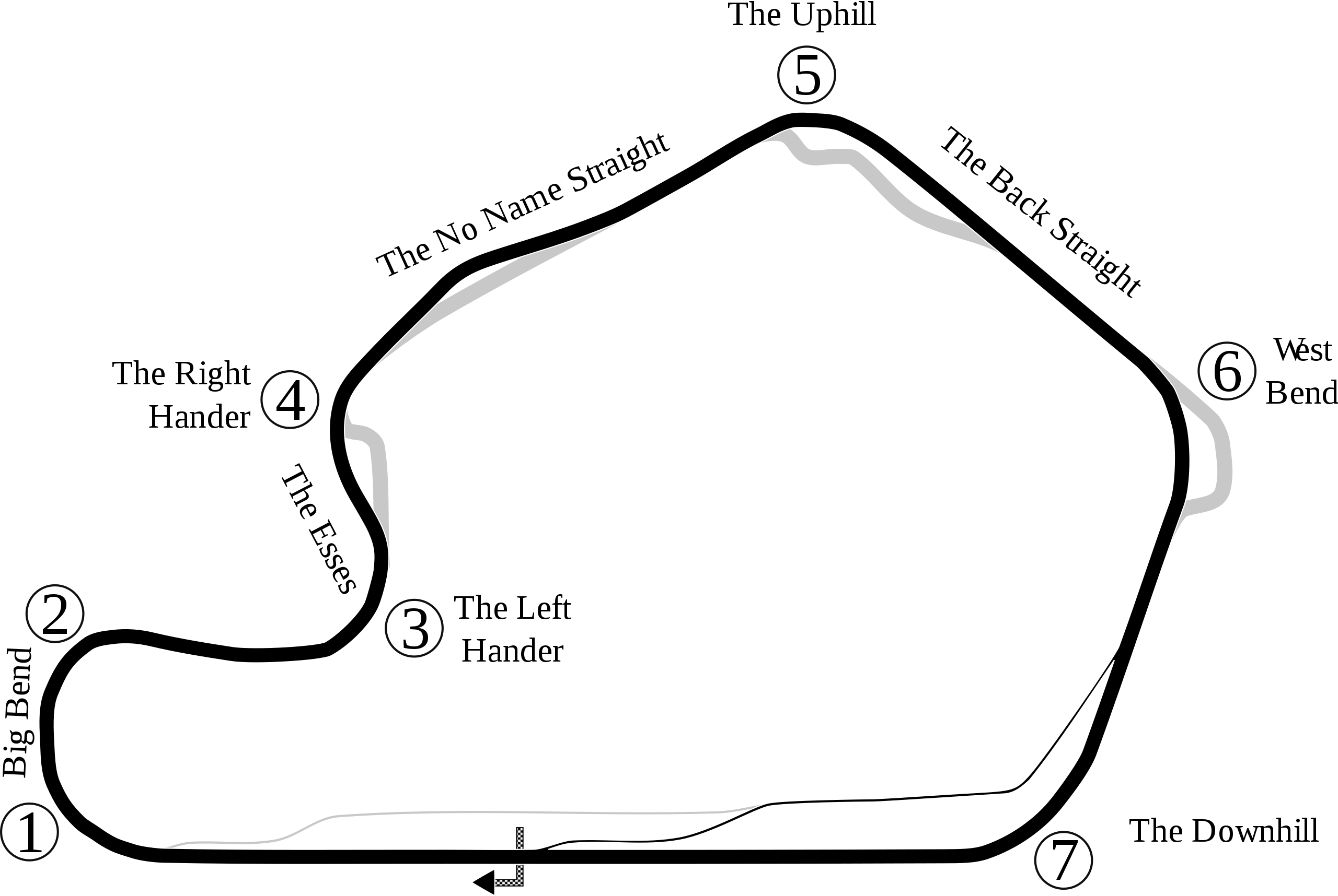
| Description | Track map of Lime Rock Park in Lakeville |
| Source | Own work |
| Author | Will Pittenger |
| Other versions |
 |
| Camera location | | View this and other nearby images on: OpenStreetMap |
|---|
Licensing
[edit]
| I, the copyright holder of this work, release this work into the public domain. This applies worldwide. In some countries this may not be legally possible; if so: I grant anyone the right to use this work for any purpose, without any conditions, unless such conditions are required by law. |
File history
Click on a date/time to view the file as it appeared at that time.
| Date/Time | Thumbnail | Dimensions | User | Comment | |
|---|---|---|---|---|---|
| current | 23:55, 17 July 2008 | | 619 × 415 (459 KB) | Will Pittenger (talk | contribs) | Still another version that rms old name |
| 23:52, 17 July 2008 |  | 619 × 415 (461 KB) | Will Pittenger (talk | contribs) | New version with updates (accuracy for this version is unknown as w:Google Earth doesn't show the changes yet) | |
| 07:27, 27 May 2008 |  | 632 × 414 (446 KB) | Will Pittenger (talk | contribs) | Added turn names, name for the chicane, straight names, start/finish line, and direction arrow. | |
| 06:42, 27 May 2008 |  | 581 × 391 (16 KB) | Will Pittenger (talk | contribs) | {{Information |Description=Track map of Lime Rock Park in Lakeville, Connecticut |Source=self-made |Date= |Author= Will Pittenger |Permission= |other_versions=[[Lime Rock Park.png|thumb|left|Version for browsers like IE7 th |
You cannot overwrite this file.
File usage on Commons
The following 3 pages use this file:
File usage on other wikis
The following other wikis use this file:
- Usage on en.wikipedia.org
- List of NASCAR tracks
- Lime Rock Park
- 2006 New England Grand Prix
- 2005 New England Grand Prix
- 2004 New England Grand Prix
- 2007 Northeast Grand Prix
- Lime Rock Grand Prix
- 2009 Northeast Grand Prix
- 1998 Lime Rock Grand Prix
- 2010 Northeast Grand Prix
- 2011 Northeast Grand Prix
- 2012 Northeast Grand Prix
- 2008 Northeast Grand Prix
- Northeast Grand Prix
- 2013 Northeast Grand Prix
- 2019 Northeast Grand Prix
- 2021 Northeast Grand Prix
- 2022 Northeast Grand Prix
- 2018 Northeast Grand Prix
- 2023 Northeast Grand Prix
- 2017 Northeast Grand Prix
- 2016 Northeast Grand Prix
- NASCAR Truck Series race at Lime Rock
- ARCA Menards Series race at Lime Rock Park
- Usage on es.wikipedia.org
- Usage on fi.wikipedia.org
- Usage on ja.wikipedia.org
- Usage on pt.wikipedia.org
- Usage on ru.wikipedia.org
- Usage on sv.wikipedia.org
- Usage on www.wikidata.org