File:Lesser Antilles 250m (cropped to Martinique Passage).jpg
Jump to navigation
Jump to search
No higher resolution available.
Lesser_Antilles_250m_(cropped_to_Martinique_Passage).jpg (600 × 600 pixels, file size: 168 KB, MIME type: image/jpeg)
Captions
Captions
Add a one-line explanation of what this file represents
Summary
[edit]| Description |
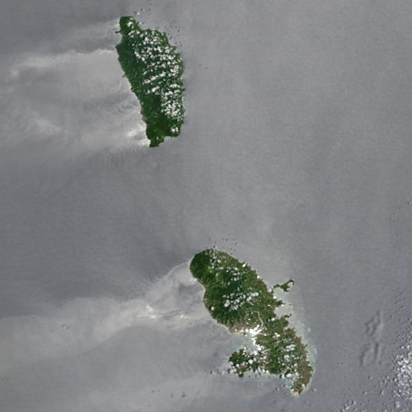
English: Dominica island, an independent republic state island, between Guadeloupe and Martinique, 2 oversea departments of the French Republic
Français : L'île de la Dominique (république independente) encadrée au nord de la Guadeloupe et les îles de la Désirade, de Marie-Galante et des Saintes ainsi qu'au sud par La Martinique, deux Départements Français d'Outre Mer. |
| Date | UTC |
| Source | extraction of the original photo Montserrat.A2002238.1450.250m.jpg at http://rapidfire.sci.gsfc.nasa.gov/gallery/?2002238-0826/Montserrat.A2002238.1450.250m.jpg |
| Author | MODIS Rapid Response Project at NASA/GSFC |

.jpg&action=edit§ion=1)
Licensing
[edit].jpg&action=edit§ion=2)
| This file is in the public domain in the United States because it was solely created by NASA. NASA copyright policy states that "NASA material is not protected by copyright unless noted". (See Template:PD-USGov, NASA copyright policy page or JPL Image Use Policy.) | ||
 |
Warnings:
|
File history
Click on a date/time to view the file as it appeared at that time.
| Date/Time | Thumbnail | Dimensions | User | Comment | |
|---|---|---|---|---|---|
| current | 09:49, 21 December 2023 | | 600 × 600 (168 KB) | Argo Navis (talk | contribs) | File:Lesser Antilles 250m.jpg cropped 28 % horizontally, 46 % vertically using CropTool with precise mode. |
You cannot overwrite this file.
File usage on Commons
The following page uses this file:
.jpg&oldid=832879696)