File:Leith Hill tower.jpg
Jump to navigation
Jump to search
Size of this preview: 250 × 600 pixels. Other resolutions: 100 × 240 pixels | 600 × 1,439 pixels.
Original file (600 × 1,439 pixels, file size: 143 KB, MIME type: image/jpeg)
Captions
Captions
Add a one-line explanation of what this file represents
Summary
[edit]
| Description |
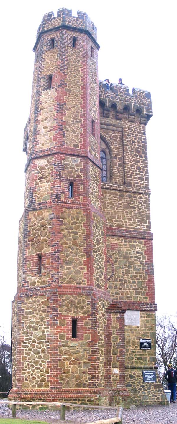
English: Leith Hill Tower on the top of Leith Hill was built in 1765 by Richard Hull with the intention, it is said, of raising the hill above 1,000 feet. He had himself buried under the tower. The Tower was restored by the National Trust in 1984, and is open to the public, commanding extensive views towards London and the English Channel, each some 40 kilometres away. It has cakes and drinks for sale to reward your efforts.
Photograph by Stephen Dawson, 24 February 2002. |
| Date | 4 February 2005 (original upload date) |
| Source | Transferred from en.wikipedia to Commons by IngerAlHaosului using CommonsHelper. |
| Author | The original uploader was StephenDawson at English Wikipedia. |
| Camera location | | View this and other nearby images on: OpenStreetMap |
|---|
Licensing
[edit]
This file is licensed under the Creative Commons Attribution-Share Alike 2.0 Generic license.
- You are free:
- to share – to copy, distribute and transmit the work
- to remix – to adapt the work
- Under the following conditions:
- attribution – You must give appropriate credit, provide a link to the license, and indicate if changes were made. You may do so in any reasonable manner, but not in any way that suggests the licensor endorses you or your use.
- share alike – If you remix, transform, or build upon the material, you must distribute your contributions under the same or compatible license as the original.

|
This image was taken from the Geograph project collection. See this photograph's page on the Geograph website for the photographer's contact details. The copyright on this image is owned by Stephen Dawson and is licensed for reuse under the Creative Commons Attribution-ShareAlike 2.0 license.
|
This file is licensed under the Creative Commons Attribution-Share Alike 2.0 Generic license.
Attribution: Stephen Dawson
- You are free:
- to share – to copy, distribute and transmit the work
- to remix – to adapt the work
- Under the following conditions:
- attribution – You must give appropriate credit, provide a link to the license, and indicate if changes were made. You may do so in any reasonable manner, but not in any way that suggests the licensor endorses you or your use.
- share alike – If you remix, transform, or build upon the material, you must distribute your contributions under the same or compatible license as the original.
Original upload log
[edit]
The original description page was here. All following user names refer to en.wikipedia.
- 2005-02-04 16:09 StephenDawson 600×1439× (146177 bytes) The tower on the summit of Leith Hill
File history
Click on a date/time to view the file as it appeared at that time.
| Date/Time | Thumbnail | Dimensions | User | Comment | |
|---|---|---|---|---|---|
| current | 13:14, 17 March 2010 | | 600 × 1,439 (143 KB) | File Upload Bot (Magnus Manske) (talk | contribs) | {{BotMoveToCommons|en.wikipedia|year={{subst:CURRENTYEAR}}|month={{subst:CURRENTMONTHNAME}}|day={{subst:CURRENTDAY}}}} {{Information |Description={{en|Leith Hill Tower on the top of en:Leith Hill was built in 1765 by Richard Hull with the intention |
You cannot overwrite this file.
File usage on Commons
There are no pages that use this file.
File usage on other wikis
The following other wikis use this file:
- Usage on en.wikipedia.org