File:Leat, Chagford - geograph.org.uk - 716592.jpg
Jump to navigation
Jump to search
Size of this preview: 450 × 600 pixels. Other resolutions: 180 × 240 pixels | 480 × 640 pixels.
Original file (480 × 640 pixels, file size: 133 KB, MIME type: image/jpeg)
Captions
Captions
Add a one-line explanation of what this file represents
Summary
[edit]
| Description |
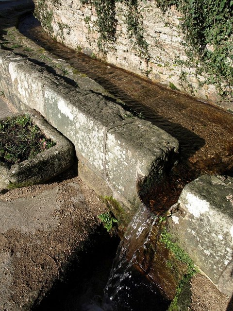
English: Leat, Chagford This feature is preserved beside New Street. Metal fittings show where a miniature sluice would have been used to prevent water escaping.
From http://www.dartmoor-npa.gov.uk/chagford-caa.pdf : "leats were and still are a particular important feature of Chagford ... {They} were cut to serve a variety of purposes, from providing the power for the various mills situated in the town, as an early town water supply, providing additional power for the electricity station, and to bring water to the four open fields situated to the west of New Street." Most are now culverted. |
| Date | |
| Source | From geograph.org.uk |
| Author | Derek Harper |
| Attribution (required by the license) | Derek Harper / Leat, Chagford / |
| Camera location | | View this and other nearby images on: OpenStreetMap |
|---|
_heading:0.00&language=en)
| Object location | | View this and other nearby images on: OpenStreetMap |
|---|
_heading:0.00&language=en)
Licensing
[edit]

|
This image was taken from the Geograph project collection. See this photograph's page on the Geograph website for the photographer's contact details. The copyright on this image is owned by Derek Harper and is licensed for reuse under the Creative Commons Attribution-ShareAlike 2.0 license.
|
This file is licensed under the Creative Commons Attribution-Share Alike 2.0 Generic license.
Attribution: Derek Harper
- You are free:
- to share – to copy, distribute and transmit the work
- to remix – to adapt the work
- Under the following conditions:
- attribution – You must give appropriate credit, provide a link to the license, and indicate if changes were made. You may do so in any reasonable manner, but not in any way that suggests the licensor endorses you or your use.
- share alike – If you remix, transform, or build upon the material, you must distribute your contributions under the same or compatible license as the original.
File history
Click on a date/time to view the file as it appeared at that time.
| Date/Time | Thumbnail | Dimensions | User | Comment | |
|---|---|---|---|---|---|
| current | 01:42, 19 February 2011 | | 480 × 640 (133 KB) | GeographBot (talk | contribs) | == {{int:filedesc}} == {{Information |description={{en|1=Leat, Chagford This feature is preserved beside New Street. Metal fittings show where a miniature sluice would have been used to prevent water escaping. From http://www.dartmoor-npa.gov.uk/chagf |
You cannot overwrite this file.
File usage on Commons
There are no pages that use this file.