File:Le cercle de la Basse Saxe ou sont les éveschés de Lubeck, et d'Hidelsheim, les duchés de Magdebourg, de Brême, de Brunswick, de Lunebourg, de Mecklenbourg, de Lawenbourg, de Holstein, la principauté... - btv1b530395239 (2 of 2).jpg
Jump to navigation
Jump to search
Size of this preview: 792 × 600 pixels. Other resolutions: 317 × 240 pixels | 634 × 480 pixels | 1,014 × 768 pixels | 1,280 × 969 pixels | 1,821 × 1,379 pixels.
Original file (1,821 × 1,379 pixels, file size: 565 KB, MIME type: image/jpeg)
Captions
Captions
Add a one-line explanation of what this file represents
Summary
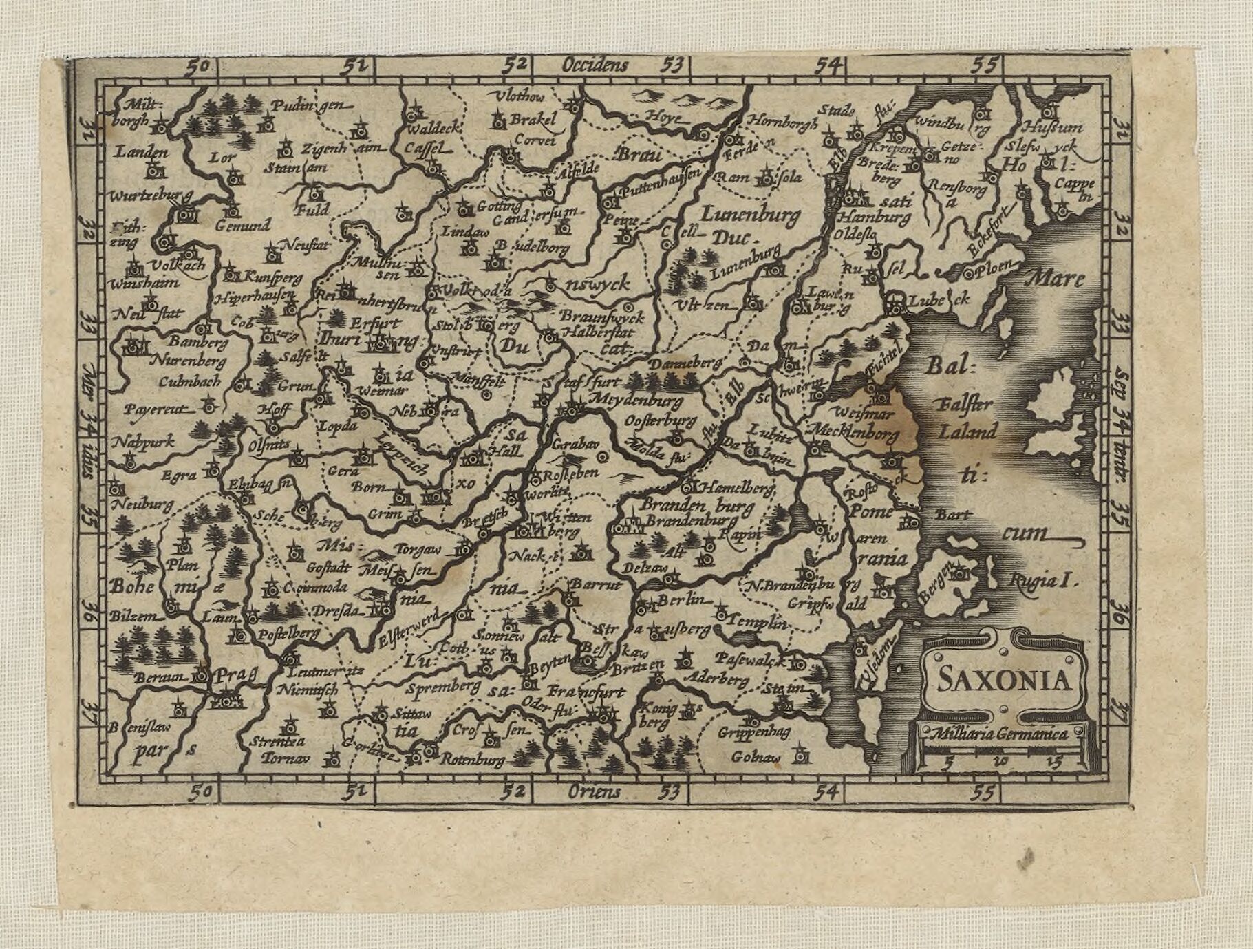
[edit]| Saxonia
( |
|||||||||||||||||||||||||||
|---|---|---|---|---|---|---|---|---|---|---|---|---|---|---|---|---|---|---|---|---|---|---|---|---|---|---|---|
| Author |
Sanson, Guillaume (1633-1703). Cartographe (dubious) |
||||||||||||||||||||||||||
| Title |
Saxonia |
||||||||||||||||||||||||||
| Description |
a map oriented to the west, showing parts of Germany under the title "Saxony". The parts include Schleswig, Eastern Lower Saxony, Mecklenburg, Pommerania, Brandenburg, Saxony-Anhalt, Saxony. The map was mixed into the folder of this map by Guillaume Sanson depicting Lower Saxony; but authorship and dates are dubious. |
||||||||||||||||||||||||||
| Date | 1681 (dubious) | ||||||||||||||||||||||||||
| Dimensions | height: 92 cm (36.2 in); width: 61 cm (24 in) (dubious) | ||||||||||||||||||||||||||
| Collection |
|
||||||||||||||||||||||||||
| References |
Français : Notice de recueil : http://catalogue.bnf.fr/ark:/12148/cb40577015h
Appartient à : Collection d'Anville ; 03841 B Notice du catalogue : http://catalogue.bnf.fr/ark:/12148/cb406408147 |
||||||||||||||||||||||||||
| Source/Photographer |
Français : Bibliothèque nationale de France, département Cartes et plans, GE DD-2987 (3841 B)
Bibliothèque nationale de France (2/2) |
||||||||||||||||||||||||||
| Permission (Reusing this file) |
|
||||||||||||||||||||||||||

.jpg&action=edit§ion=1)
.jpg)
File history
Click on a date/time to view the file as it appeared at that time.
| Date/Time | Thumbnail | Dimensions | User | Comment | |
|---|---|---|---|---|---|
| current | 01:10, 12 July 2022 | | 1,821 × 1,379 (565 KB) | Gzen92Bot (talk | contribs) | Gallica btv1b530395239 |
You cannot overwrite this file.
File usage on Commons
The following page uses this file:
.jpg)
.jpg&oldid=825882057)