File:Laysanc aerial.jpg
Jump to navigation
Jump to search
No higher resolution available.
Laysanc_aerial.jpg (400 × 313 pixels, file size: 20 KB, MIME type: image/jpeg)
Captions
Captions
Add a one-line explanation of what this file represents
Summary
[edit]
| Description |
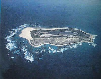
Deutsch: Luftaufnahme der Insel Laysan, Nordwestliche Hawaii-Inseln
English: Aerial view of Laysan Island, Northwestern Hawaiian Islands |
| Date | Unknown date |
| Source | http://atsea.nmfs.hawaii.edu/islands/laysan.htm |
| Author | George H. Balazs, NOAA |
| Permission (Reusing this file) |
see NOAA Student Connection Privacy Notice |
Licensing
[edit]
This image is in the public domain because it contains materials that originally came from the U.S. National Oceanic and Atmospheric Administration, taken or made as part of an employee's official duties.
|

|
Textual information (e.g. timestamp) once visible in the image itself has been moved into the image metadata and/or image description page. This makes the image easier to reuse and more language-neutral, and makes the text easier to process and search for. Commons discourages placing visible textual information in images. All licenses accepted on Commons permit this type of modification as a derivative work.
If attribution information were removed and the image is not public domain, replace this tag with {{Attribution metadata from licensed image}}.
|
File history
Click on a date/time to view the file as it appeared at that time.
| Date/Time | Thumbnail | Dimensions | User | Comment | |
|---|---|---|---|---|---|
| current | 12:51, 16 June 2008 | | 400 × 313 (20 KB) | Telim tor (talk | contribs) | == Information == {{Information |Description= {{de|Luftaufnahme der Insel Laysan, Nordwestliche Hawaii-Inseln}} {{en|Aerial view of Laysan Island, Northwestern Hawaiian Islands}} |Source=http://atsea.nmfs.hawaii.edu/islands/laysan.htm |Date=unknown |Autho |
You cannot overwrite this file.
File usage on Commons
There are no pages that use this file.