File:LavaCreekTuff.jpg
Jump to navigation
Jump to search
Size of this preview: 800 × 562 pixels. Other resolutions: 320 × 225 pixels | 640 × 449 pixels | 1,024 × 719 pixels | 1,280 × 899 pixels | 2,048 × 1,438 pixels.
Original file (2,048 × 1,438 pixels, file size: 566 KB, MIME type: image/jpeg)
Captions
Captions
The area that the lava will reach.
Summary
[edit]
| Description |
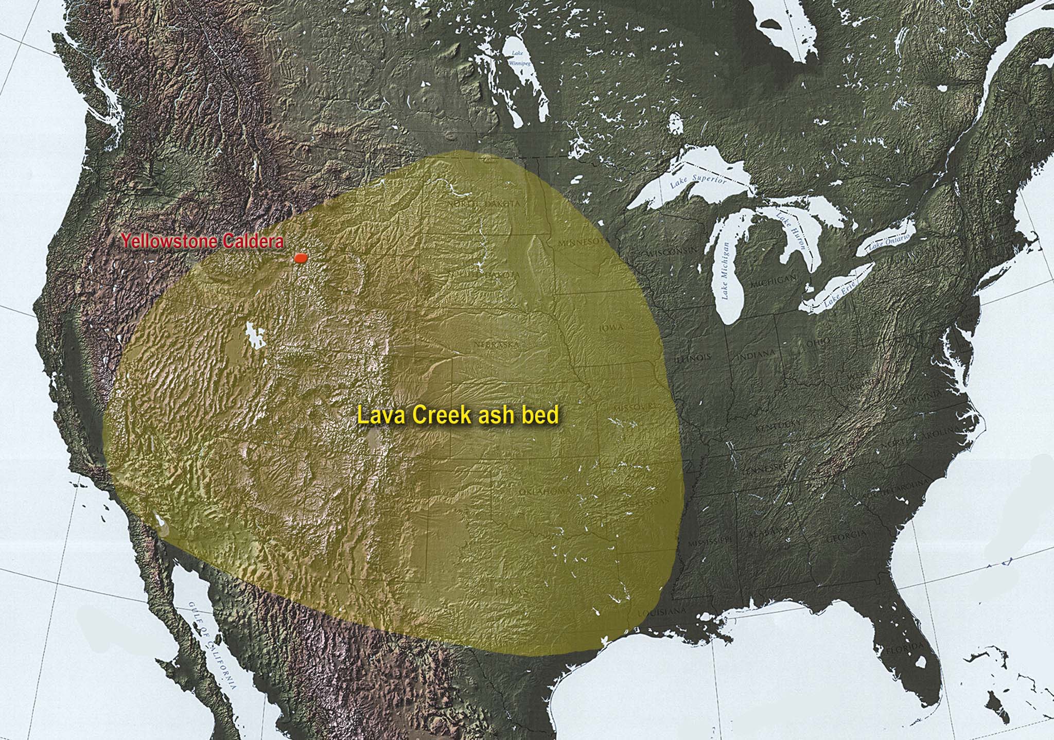
English: Graphic of the extent of the Lava Creek ash bed. |
| Date | 14 December 2008 (original upload date) |
| Source | Transferred from en.wikipedia to Commons. |
| Author | Metrodyne at English Wikipedia |
Licensing
[edit]
| This work has been released into the public domain by its author, Metrodyne at English Wikipedia. This applies worldwide. In some countries this may not be legally possible; if so: Metrodyne grants anyone the right to use this work for any purpose, without any conditions, unless such conditions are required by law. |
Original upload log
[edit]
The original description page was here. All following user names refer to en.wikipedia.
| Date/Time | Dimensions | User | Comment |
|---|---|---|---|
| 2008-12-14 10:00 | 2048×1438× (579483 bytes) | Metrodyne | Graphic of the extend of the Lava Creek ash bed. |
File history
Click on a date/time to view the file as it appeared at that time.
| Date/Time | Thumbnail | Dimensions | User | Comment | |
|---|---|---|---|---|---|
| current | 11:01, 10 March 2016 | | 2,048 × 1,438 (566 KB) | Arjuno3 (talk | contribs) | Transferred from en.wikipedia |
You cannot overwrite this file.
File usage on Commons
There are no pages that use this file.
File usage on other wikis
The following other wikis use this file:
- Usage on en.wikipedia.org
- Usage on es.wikipedia.org
- Usage on fr.wikipedia.org
- Usage on it.wikipedia.org
- Usage on ru.wikipedia.org
- Usage on uk.wikipedia.org
Metadata
Categories:
- Volcanic ash in the United States
- Lava Creek Tuff - volcanic ash distribution maps
- Ash distribution maps of historical eruptions in the United States
- Yellowstone hotspot
- Volcanism of the Yellowstone Caldera
- Pleistocene volcanism of Wyoming
- Ash horizons (volcanic)
- Pleistocene formations in North Dakota
- Pleistocene formations in South Dakota
- Pleistocene formations in Nebraska
- Pleistocene formations in Kansas
- Pleistocene formations in New Mexico
- Pleistocene formations in Texas
- Pleistocene formations in Colorado
- Pleistocene formations in Utah
- Pleistocene formations in Nevada
- Pleistocene formations in California
- Pleistocene formations in Canada
- Pleistocene formations in Montana