File:Late March 2023 Tornado Outbreak 2023-03-24.jpg
Jump to navigation
Jump to search
Size of this preview: 533 × 600 pixels. Other resolutions: 213 × 240 pixels | 427 × 480 pixels | 683 × 768 pixels | 910 × 1,024 pixels | 1,820 × 2,048 pixels | 4,000 × 4,500 pixels.
Original file (4,000 × 4,500 pixels, file size: 16.87 MB, MIME type: image/jpeg)
Captions
Captions
Add a one-line explanation of what this file represents
Summary
[edit]
| Description |
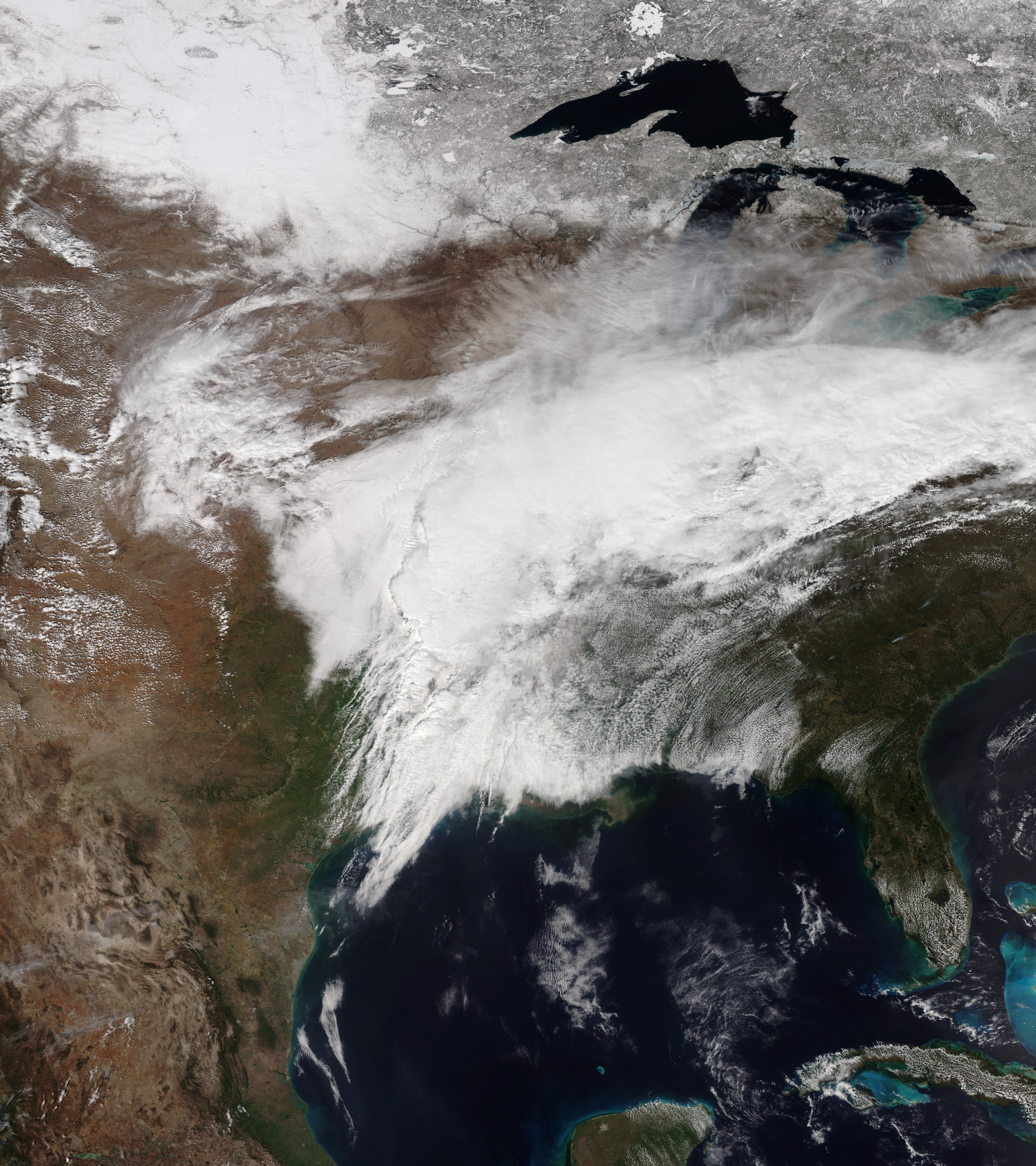
English: This true-color image of the storm system which produced a tornado outbreak and squall line in Late March of 2023 was captured on the afternoon of March 24, 2023, by the Visible Infrared Imaging Radiometer Suite (VIIRS) instrument flying aboard the NOAA-20 satellite. The storm system was deepening over the Arkansas-Texas state line when this image was captured. This storm system would go on and produce a tornadic supercell that went through the towns of Rolling Fork and Sliver City in Mississippi, causing casualties and injuries, and catastrophic damages in those towns later the same day. The pressure of the storm system was at or around 1,004 mbar (29.6 inHg). |
| Date | |
| Source | NOAA View Global Data Explorer |
| Author | NOAA/NOAA-20 |
Licensing
[edit]
This image is in the public domain because it contains materials that originally came from the U.S. National Oceanic and Atmospheric Administration, taken or made as part of an employee's official duties.
|
File history
Click on a date/time to view the file as it appeared at that time.
| Date/Time | Thumbnail | Dimensions | User | Comment | |
|---|---|---|---|---|---|
| current | 11:34, 25 March 2023 | | 4,000 × 4,500 (16.87 MB) | TheWxResearcher (talk | contribs) | Uploaded a work by NOAA/NOAA-20 from [https://www.nnvl.noaa.gov/view/#TRUE NOAA View Global Data Explorer] with UploadWizard |
You cannot overwrite this file.
File usage on Commons
There are no pages that use this file.