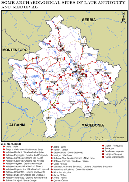
File:LateAntiqueMap.PNG
From Wikimedia Commons, the free media repository
Jump to navigation
Jump to search

Size of this preview: 426 × 599 pixels. Other resolutions: 170 × 240 pixels | 341 × 480 pixels | 956 × 1,345 pixels.
Original file (956 × 1,345 pixels, file size: 321 KB, MIME type: image/png)
File information
Structured data
Captions
Captions
Add a one-line explanation of what this file represents
Summary
[edit]| DescriptionLateAntiqueMap.PNG |
This file has no description, and may be lacking other information.
Please provide a meaningful description of this file. |
| Date | |
| Source | www.mkrs-ks.org/repository/docs/drafti_i_guides_-anglisht_final.pdf |
| Author | Instituti Arkeologjik I Kosoves |
Licensing
[edit]| Public domainPublic domainfalsefalse |
This work was first published in Kosovo and is now in the public domain by virtue of the Law No. 04/L-065 on Copyright and Related Rights of 2011[1] because it is not afforded protection due to falling in one of the following categories (details):
It is asserted that this work falls into one or more of the above categories and is public domain. |
 |
File history
Click on a date/time to view the file as it appeared at that time.
| Date/Time | Thumbnail | Dimensions | User | Comment | |
|---|---|---|---|---|---|
| current | 18:25, 13 March 2013 |  | 956 × 1,345 (321 KB) | Atdheu (talk | contribs) | User created page with UploadWizard |
You cannot overwrite this file.
File usage on Commons
There are no pages that use this file.
File usage on other wikis
The following other wikis use this file:
- Usage on bn.wikipedia.org
- Usage on en.wikipedia.org
- Usage on hy.wikipedia.org
- Usage on id.wikipedia.org
- Usage on it.wikipedia.org
- Usage on sl.wikipedia.org
- Usage on sq.wikipedia.org
- Usage on uk.wikipedia.org