File:Laor Sri Lanka Map.jpg
Jump to navigation
Jump to search

Size of this preview: 714 × 599 pixels. Other resolutions: 286 × 240 pixels | 572 × 480 pixels | 915 × 768 pixels | 1,220 × 1,024 pixels | 2,440 × 2,048 pixels | 13,667 × 11,471 pixels.
Original file (13,667 × 11,471 pixels, file size: 19.89 MB, MIME type: image/jpeg)
Captions
Captions
Add a one-line explanation of what this file represents
Summary
[edit]| Title |
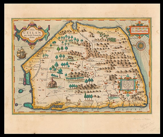
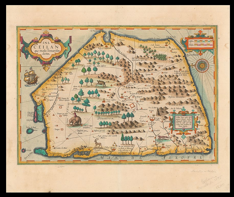
Ins. Ceilan, quæ incolís Tenarifin dicitur [cartographic material] / dedit clarissismus vir Petrus Plancius. |
|||||||||||||||||||||||
| Description |
English: Map of Sri Lanka by Petrus Plancius, 16th century.
עברית: מפת סרי לנקה שנוצרה על ידי פטרוס פלנציוס, המאה ה 16
Dimensions: 49x34 cm. |
|||||||||||||||||||||||
| Date | ||||||||||||||||||||||||
| Source | National Library of Israel | |||||||||||||||||||||||
| Creator |
|
|||||||||||||||||||||||
| Georeferencing | If inappropriate please set warp_status = skip to hide. | |||||||||||||||||||||||
| Archival data | ||||||||||||||||||||||||
| Collection |
|
|||||||||||||||||||||||

Licensing
[edit]
|
This is a faithful photographic reproduction of a two-dimensional, public domain work of art. The work of art itself is in the public domain for the following reason:
The official position taken by the Wikimedia Foundation is that "faithful reproductions of two-dimensional public domain works of art are public domain".
This photographic reproduction is therefore also considered to be in the public domain in the United States. In other jurisdictions, re-use of this content may be restricted; see Reuse of PD-Art photographs for details. | ||||
File history
Click on a date/time to view the file as it appeared at that time.
| Date/Time | Thumbnail | Dimensions | User | Comment | |
|---|---|---|---|---|---|
| current | 10:30, 10 July 2022 | | 13,667 × 11,471 (19.89 MB) | Shimon.tre (talk | contribs) | == {{int:filedesc}} == {{map |Title=Ins. Ceilan, quæ incolís Tenarifin dicitur [cartographic material] / dedit clarissismus vir Petrus Plancius. |Description= {{en|1=Map of Sri Lanka by Petrus Plancius, 16th century.}} {{he|1=מפת סרי לנקה שנוצרה על ידי פטרוס פלנציוס, המאה ה 16}} Dimensions: 49x34 cm. |Source=[https://www.nli.org.il/he/maps/NNL_ALEPH002514032/NLI#$FL35472048 National Library of Israel] |institution = {{Institution:National Library of Israel}} |Date={{other date||1595}} |Author... |
You cannot overwrite this file.
File usage on Commons
There are no pages that use this file.