File:Lange diercke sachsen dresden und umgegend.jpg
Jump to navigation
Jump to search

Size of this preview: 755 × 600 pixels. Other resolutions: 302 × 240 pixels | 604 × 480 pixels | 967 × 768 pixels | 1,280 × 1,017 pixels | 2,560 × 2,034 pixels | 3,844 × 3,054 pixels.
Original file (3,844 × 3,054 pixels, file size: 11.7 MB, MIME type: image/jpeg)
Captions
Captions
Add a one-line explanation of what this file represents
| Lange-Diercke – Sächsischer Schulatlas | ||||
|---|---|---|---|---|
| Author |
Anonymous |
 | ||
| Title |
Lange-Diercke – Sächsischer Schulatlas |
|||
| Subtitle | Ausgabe für Dresden | |||
| Publisher |
Georg Westermann (Braunschweig) Carl Adlers Buchhandlung (Dresden) |
|||
| Description |
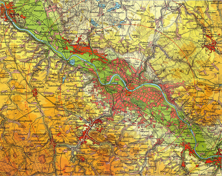
English: Dresden and hinterland (altitudes: green=0-120m, light green=120-150m, light yellow=150-200m, yellow=200-250m, light orange=250-300m, orange=300-350m, light brown=350-400m, brown=more than 400m)
Deutsch: Dresden und Umgegend (Umgebung) (Höhen: grün=0-120m, hellgrün=120-150m, hellgelb=150-200m, gelb=200-250m, hellorange=250-300m, orange=300-350m, hellbraun=350-400m, braun=über 400m)
Français : Dresde et environs (altitudes: vert=0-120m, vert clair=120-150m, jaune clair=150-200m, jaune=200-250m, orange clair=250-300m, orange=300-350m, brun clair=350-400m, brun=plus de 400m)
English: This is a part of an old atlas. It does not necessarily represent the current situation. |
|||
| Publication date | circa 1930 | |||
| Place of publication | Brunswick, Dresden | |||
| Permission (Reusing this file) |
|
|||
File history
Click on a date/time to view the file as it appeared at that time.
| Date/Time | Thumbnail | Dimensions | User | Comment | |
|---|---|---|---|---|---|
| current | 13:41, 22 January 2011 | | 3,844 × 3,054 (11.7 MB) | Bananenfalter (talk | contribs) | {{Lange-Diercke_Sachsen |Description={{de|1=Dresden und Umgegend (Höhen: grün=0-120m, hellgrün=120-150m, hellgelb=150-200m, gelb=200-250m, hellorange=250-300m, orange=300-350m, hellbraun=350-400m, braun=über 400m)}} |Author=[[User:Bananenfalter|Banane |
You cannot overwrite this file.
File usage on Commons
The following page uses this file:
File usage on other wikis
The following other wikis use this file:
- Usage on de.wikipedia.org
- Usage on de.wikibooks.org
- Usage on en.wikipedia.org
- Usage on www.wikidata.org