File:Landmannalaugar from above, Iceland 2013. - panoramio.jpg
Jump to navigation
Jump to search
Size of this preview: 399 × 599 pixels. Other resolutions: 160 × 240 pixels | 320 × 480 pixels | 512 × 768 pixels | 682 × 1,024 pixels | 1,365 × 2,048 pixels.
Original file (1,365 × 2,048 pixels, file size: 1.63 MB, MIME type: image/jpeg)
Captions
Captions
Add a one-line explanation of what this file represents
Summary
[edit]
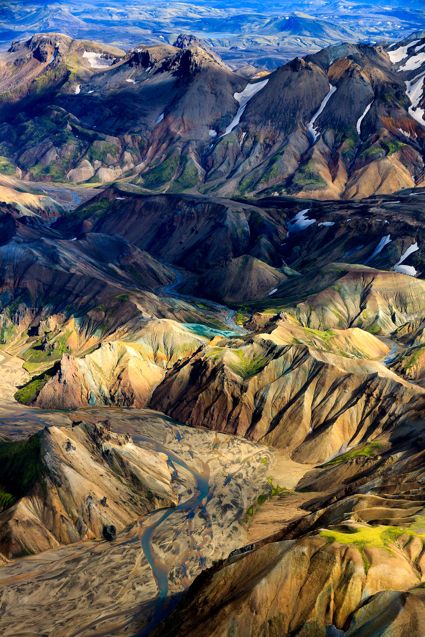
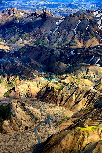
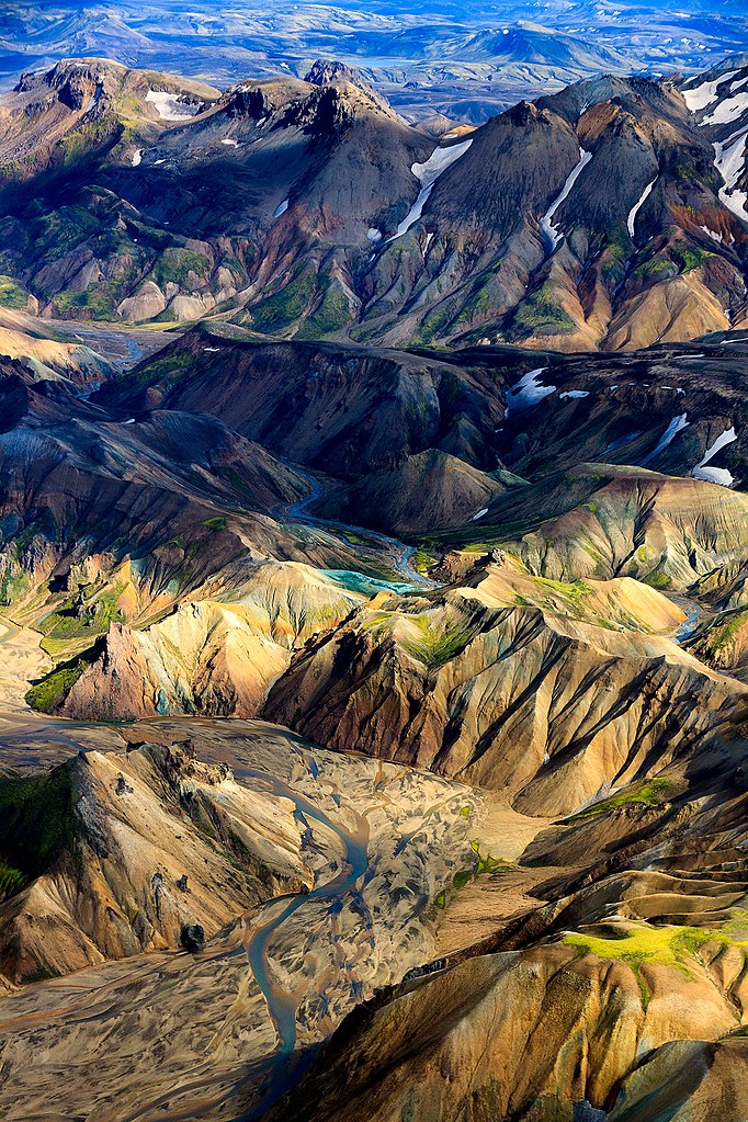
| Description | Landmannalaugar from above, Iceland 2013. | ||
| Date | Taken on 20 August 2013 | ||
| Source | https://web.archive.org/web/20161029145656/http://www.panoramio.com/photo/95577734 | ||
| Author | Stig Nygaard | ||
| Permission (Reusing this file) |
This file is licensed under the Creative Commons Attribution 3.0 Unported license. Attribution: Stig Nygaard
|
||
| Tags (from Panoramio photo page) | Southern Region, 2013, 50D, aerial, airplane, Canon EF-S 15-85mm f_3.5-5.6 IS USM, Canon EOS 50D, Creative Commons, Fjallabak, Fjallabak Nature Reserve, flight, Grafarkirkja, hill, Iceland, Islandia, Islenska, Landmannalaugar, Lýðveldið Ísland, Photo by Stig Nygaard, Republic of Iceland, Suðurland |
| Camera location | | View this and other nearby images on: OpenStreetMap |
|---|
File history
Click on a date/time to view the file as it appeared at that time.
| Date/Time | Thumbnail | Dimensions | User | Comment | |
|---|---|---|---|---|---|
| current | 04:23, 1 March 2017 | | 1,365 × 2,048 (1.63 MB) | Panoramio upload bot (talk | contribs) | == {{int:filedesc}} == {{Information |description=Landmannalaugar from above, Iceland 2013. |date={{Taken on|2013-08-20}} |source=http://www.panoramio.com/photo/95577734 |author=[http://www.panoramio.com/user/6104255?with_photo_id=95577734 Stig Nygaard... |
You cannot overwrite this file.
File usage on Commons
There are no pages that use this file.