File:Landappbw 933755 1817 Kemnater Achsen- Achsenpunkt "Die Neue Mühle" Ostfildern-Kemnat.jpg
Jump to navigation
Jump to search

Size of this preview: 800 × 370 pixels. Other resolutions: 320 × 148 pixels | 640 × 296 pixels | 1,024 × 474 pixels | 1,920 × 889 pixels.
Original file (1,920 × 889 pixels, file size: 267 KB, MIME type: image/jpeg)
Captions
Captions
Add a one-line explanation of what this file represents
Summary
[edit]
| Description |
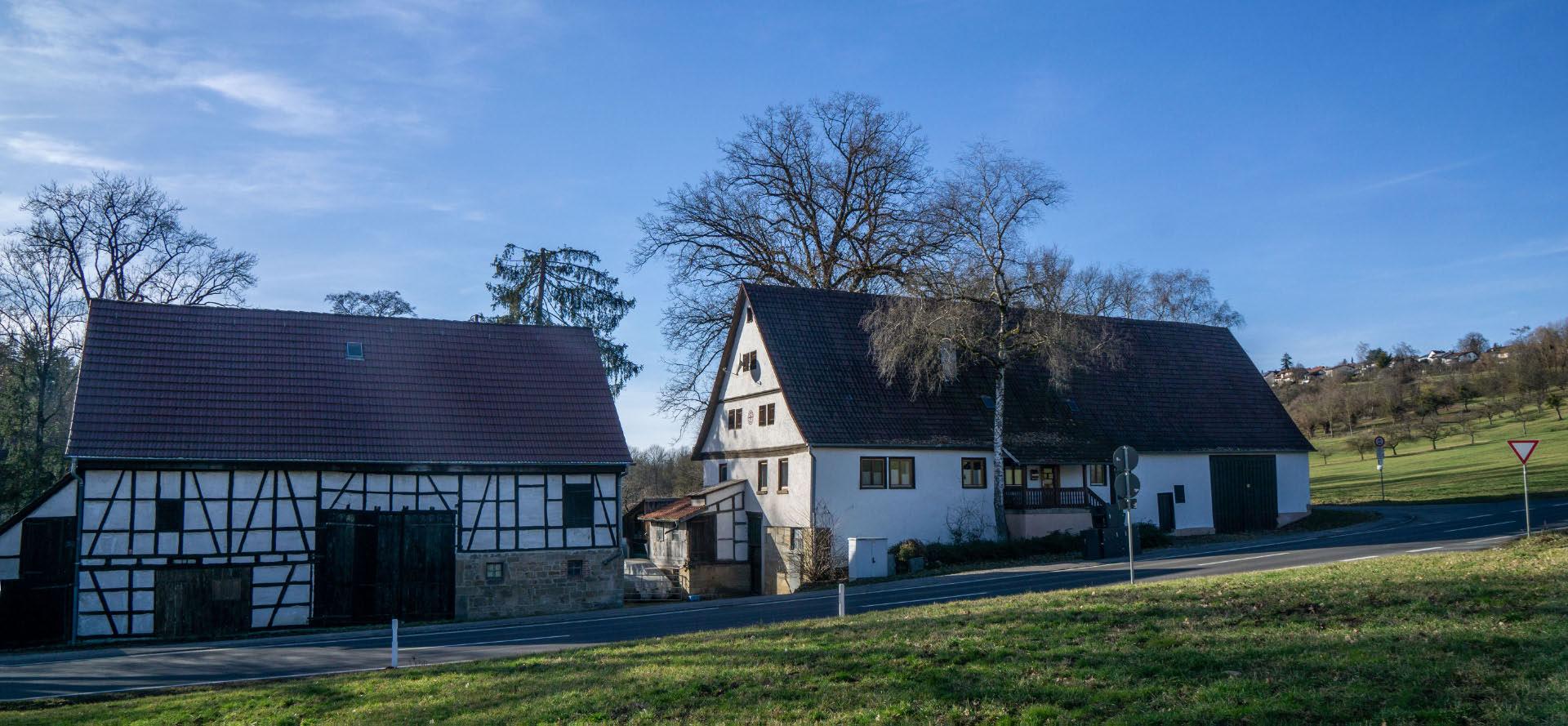
Deutsch: An der Rohrstange des Verkehrszeichens befindet sich ein Aufkleber mit einem QR-Code. Wenn man diesen scannt und die Internetseite aufruft, erfährt man mehr zur „Neuen Mühle“. Sie war eine von mehreren Mühlen im Körschtal, wurde bereits im 13. Jh. erwähnt, und ging letztlich 1970 außer Betrieb, heute privates Wohngebäude. |
| Date | 22 February 2024, 17:57:18 (original upload date) |
| Source | overview - direct - dataset |
| Author | Willi Bautz |
| Permission (Reusing this file) |
Creative Commons Zero (CC0) |
| ID | 933755 |
| Category | 1829 |
| Object location | | View this and other nearby images on: OpenStreetMap |
|---|
This media file was collected by Landauf, LandApp under the ID 933755. This tag does not indicate the copyright status of the attached work. A normal copyright tag is still required. See Commons:Licensing. |
Licensing
[edit]
| This file is made available under the Creative Commons CC0 1.0 Universal Public Domain Dedication. | |
| The person who associated a work with this deed has dedicated the work to the public domain by waiving all of their rights to the work worldwide under copyright law, including all related and neighboring rights, to the extent allowed by law. You can copy, modify, distribute and perform the work, even for commercial purposes, all without asking permission.
|
File history
Click on a date/time to view the file as it appeared at that time.
| Date/Time | Thumbnail | Dimensions | User | Comment | |
|---|---|---|---|---|---|
| current | 22:52, 23 February 2024 | | 1,920 × 889 (267 KB) | LaserlichtBot (talk | contribs) | =={{int:filedesc}}== {{Information |description={{de|1=An der Rohrstange des Verkehrszeichens befindet sich ein Aufkleber mit einem QR-Code. Wenn man diesen scannt und die Internetseite aufruft, erfährt man mehr zur „Neuen Mühle“. Sie war eine von mehreren Mühlen im Körschtal, wurde bereits im 13. Jh. erwähnt, und ging letztlich 1970 außer Betrieb, heute privates Wohngebäude.}} |date={{Original upload date|2024-02-22 17:57:18}} |source=[https://www.spotteron.com/landappbw/spots/933755 overvie... |
You cannot overwrite this file.
File usage on Commons
The following page uses this file: