File:Landappbw 261488 1817 Kirche "Zu Allen Heiligen" und Pfarramt Untersontheim Untersontheim.jpg
Jump to navigation
Jump to search

Size of this preview: 800 × 451 pixels. Other resolutions: 320 × 180 pixels | 640 × 361 pixels | 1,024 × 577 pixels | 1,280 × 722 pixels | 3,264 × 1,840 pixels.
Original file (3,264 × 1,840 pixels, file size: 701 KB, MIME type: image/jpeg)
Captions
Captions
Add a one-line explanation of what this file represents
Summary
[edit]
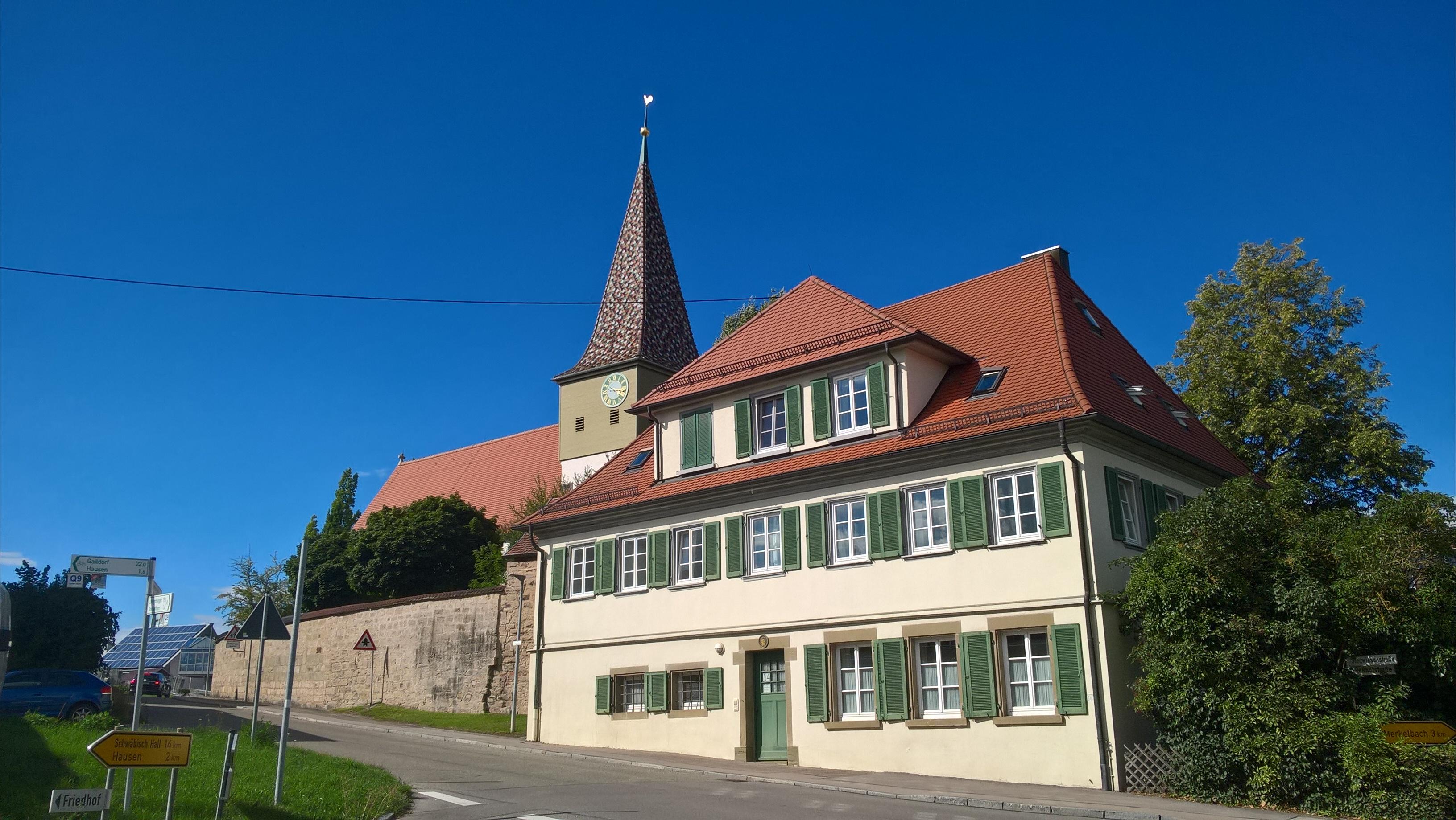
| Description | Der Kirchhof mit der Kirche Allerheiligen (um 1659 Sankt Franziskus) liegt erhöht mitten im Dorf. Die kleine, einschiffige evangelische Pfarrkirche mit Turmchor wird zu den mittelalterlichen Wehrkirchen gezählt. Erwähnenswert ist das romanische Tympanon über dem Südportal mit Sonnenscheibe, Kreuz und Mondsichel |
| Date | 23 August 2020, 18:22:56 (original upload date) |
| Source | overview - direct - dataset |
| Author | Roland Knobloch |
| Permission (Reusing this file) |
Creative Commons Zero (CC0) |
| ID | 261488 |
| Category | 1829 |
| Object location | | View this and other nearby images on: OpenStreetMap |
|---|
This media file was collected by Landauf, LandApp under the ID 261488. This tag does not indicate the copyright status of the attached work. A normal copyright tag is still required. See Commons:Licensing. |
Licensing
[edit]
| This file is made available under the Creative Commons CC0 1.0 Universal Public Domain Dedication. | |
| The person who associated a work with this deed has dedicated the work to the public domain by waiving all of their rights to the work worldwide under copyright law, including all related and neighboring rights, to the extent allowed by law. You can copy, modify, distribute and perform the work, even for commercial purposes, all without asking permission.
|
File history
Click on a date/time to view the file as it appeared at that time.
| Date/Time | Thumbnail | Dimensions | User | Comment | |
|---|---|---|---|---|---|
| current | 05:47, 3 May 2023 | | 3,264 × 1,840 (701 KB) | LaserlichtBot (talk | contribs) | =={{int:filedesc}}== {{Information |description= |date=2020-08-23 18:22:56 |source=[https://www.spotteron.com/landappbw/spots/261488 overview] - [https://files.spotteron.com/images/spots/000022/2020/08/6ko24kdriffhfhlp5eysinu5reasbc8g.jpg direct] |author=[https://www.spotteron.com/landappbw/users/20689/spots Roland Knobloch] |permission=[https://www.spotteron.com/landappbw/info Creative Commons Zero (CC0)] |other fields={{Information field |name=ID |value=261488 }}{{Information field |name=Ca... |
You cannot overwrite this file.
File usage on Commons
The following page uses this file: