File:Land- of routekaart in Ghana, RP-T-1994-158-B.jpg
Jump to navigation
Jump to search

Size of this preview: 496 × 600 pixels. Other resolutions: 198 × 240 pixels | 397 × 480 pixels | 635 × 768 pixels | 847 × 1,024 pixels | 1,350 × 1,632 pixels.
Original file (1,350 × 1,632 pixels, file size: 244 KB, MIME type: image/jpeg)
Captions
Captions
Add a one-line explanation of what this file represents
Summary
[edit]
| Description |
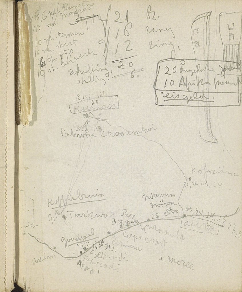
Nederlands: Identificatie Titel(s): Land- of routekaart in Ghana Objecttype: schetsboekblad schutblad Objectnummer: RP-T-1994-158-B Opschriften / Merken: annotatie, handgeschreven in potlood: ‘[...] 10 sh rennen/ 10 sh shirt/ 6 sh pijp/ 10 sh leerwerk/ [...]/ Kumase/ Koforidua/ koffiebruin/ [...]’ Omschrijving: Achterste schutblad uit een schetsboek met 60 bladen. Vervaardiging Vervaardiger: tekenaar: Reijer Stolk Plaats vervaardiging: Ghana Datering: ca. 1916 - ca. 1945 Fysieke kenmerken: potlood Materiaal: papier potlood Onderwerp Wat: maps of separate countries or regions Verwerving en rechten Credit line: Schenking van de heer P. Stolk, Den Haag Verwerving: schenking 1994 Copyright: Publiek domein |
| Date | ca. 1916 - ca. 1945 |
| Source | http://hdl.handle.net/10934/RM0001.COLLECT.573523 |
| Author | Rijksmuseum |
Licensing
[edit]
| This file is made available under the Creative Commons CC0 1.0 Universal Public Domain Dedication. | |
| The person who associated a work with this deed has dedicated the work to the public domain by waiving all of their rights to the work worldwide under copyright law, including all related and neighboring rights, to the extent allowed by law. You can copy, modify, distribute and perform the work, even for commercial purposes, all without asking permission.
|
File history
Click on a date/time to view the file as it appeared at that time.
| Date/Time | Thumbnail | Dimensions | User | Comment | |
|---|---|---|---|---|---|
| current | 07:09, 12 January 2020 | | 1,350 × 1,632 (244 KB) | Mr.Nostalgic (talk | contribs) | == {{int:filedesc}} == {{Information |Description={{nl|1=<br><br><big>'''Identificatie'''</big><br>'''Titel(s): '''Land- of routekaart in Ghana<br>'''Objecttype:''' schetsboekblad schutblad <br>'''Objectnummer:''' RP-T-1994-158-B<br>'''Opschriften / Merken:''' annotatie, handgeschreven in potlood: ‘[...] 10 sh rennen/ 10 sh shirt/ 6 sh pijp/ 10 sh leerwerk/ [...]/ Kumase/ Koforidua/ koffiebruin/ [...]’<br>'''Omschrijving:''' Achterste schutblad uit een schetsboek met 60 bladen.<br><br><big>''... |
You cannot overwrite this file.
File usage on Commons
There are no pages that use this file.