File:Lake turkana satellite-HE.jpg
Jump to navigation
Jump to search
Size of this preview: 800 × 593 pixels. Other resolutions: 320 × 237 pixels | 640 × 474 pixels | 992 × 735 pixels.
Original file (992 × 735 pixels, file size: 199 KB, MIME type: image/jpeg)
Captions
Captions
Add a one-line explanation of what this file represents
Summary
[edit]
| Description |
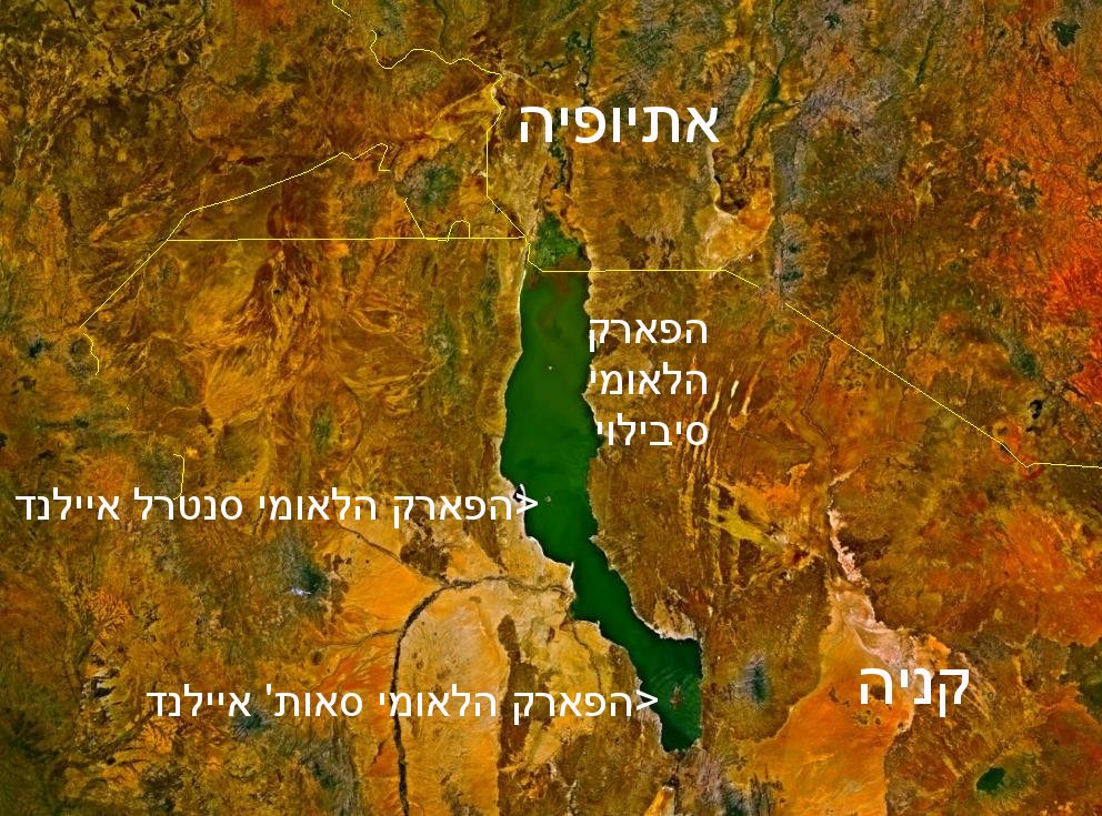
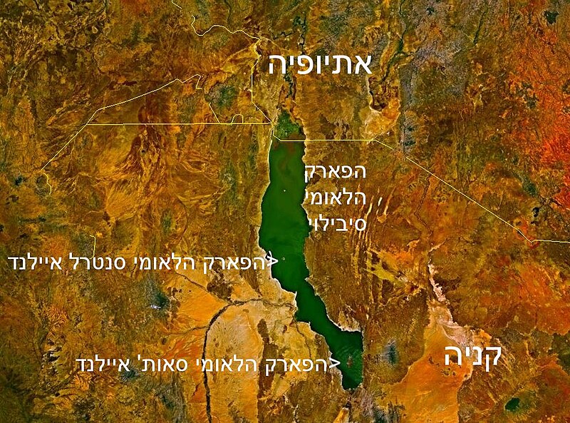
Deutsch: Satellitenbild des Turkana-Sees auf den Staatsgebieten von Kenia und Äthiopien mit hebräischer Beschriftung. Die Staatsgrenzen sind als gelbe Linien eingezeichnet.
parchi naziunali Turkana |
| Source | File:Lake turkana satellite.jpg with inscriptions |
| Author | Ori~ |
| Other versions | File:Lake turkana satellite.jpg |
Licensing
[edit]
| This image is in the public domain because it is a screenshot from NASA’s globe software World Wind using a public domain layer, such as Blue Marble, MODIS, Landsat, SRTM, USGS or GLOBE.
|
 |
File history
Click on a date/time to view the file as it appeared at that time.
| Date/Time | Thumbnail | Dimensions | User | Comment | |
|---|---|---|---|---|---|
| current | 04:32, 9 November 2009 | | 992 × 735 (199 KB) | Ori~ (talk | contribs) | {{Information |Description=parchi naziunali Turkana |Source=own after file:Lake turkana satellite.jpg |Date=2009-11-09 |Author= Ori~ |Permission= |other_versions= }} Category:Lake Turkana [Category:Satellite pictures of Ethiopia |
You cannot overwrite this file.
File usage on Commons
There are no pages that use this file.
File usage on other wikis
The following other wikis use this file:
- Usage on he.wikipedia.org