File:Lake Burien.jpg
Jump to navigation
Jump to search
No higher resolution available.
Lake_Burien.jpg (216 × 205 pixels, file size: 42 KB, MIME type: image/jpeg)
Captions
Captions
Add a one-line explanation of what this file represents
Summary
[edit]| Description |
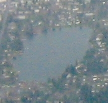
English: Aerial view of Three Tree Point near Seattle, surrounded by Burien, with SeaTac International Airport behind it. |
| Date | |
| Source | Own work |
| Author | Dcoetzee |
| Other versions |

| Camera location | | View this and other nearby images on: OpenStreetMap |
|---|
Licensing
[edit]
| I, the copyright holder of this work, release this work into the public domain. This applies worldwide. In some countries this may not be legally possible; if so: I grant anyone the right to use this work for any purpose, without any conditions, unless such conditions are required by law. |
File history
Click on a date/time to view the file as it appeared at that time.
| Date/Time | Thumbnail | Dimensions | User | Comment | |
|---|---|---|---|---|---|
| current | 05:43, 24 December 2023 | | 216 × 205 (42 KB) | DirtyHarry991 (talk | contribs) | File:Aerial view of Three Tree Point, Burien, and SeaTac.jpg cropped 93 % horizontally, 92 % vertically using CropTool with precise mode. |
You cannot overwrite this file.
File usage on Commons
The following page uses this file:
File usage on other wikis
The following other wikis use this file:
- Usage on en.wikipedia.org