File:Lair of Aldararie. - geograph.org.uk - 118329.jpg
Jump to navigation
Jump to search
No higher resolution available.
Lair_of_Aldararie._-_geograph.org.uk_-_118329.jpg (640 × 480 pixels, file size: 90 KB, MIME type: image/jpeg)
Captions
Captions
Add a one-line explanation of what this file represents
Summary
[edit]
| Description |
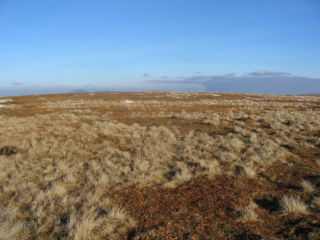
English: Lair of Alderarie. Approaching the top from the south. The summit, if you can identify it is in the next square, but most of this shot is in NO3177. The cloud is caused by burning heather. The smoke is trapped by a layer of warmer air (typical anticyclonic conditions) but is also acting as nucleii for condensation, forming a normal cloud. The gamies in Glen Esk are modifying weather.
Lair of Alderarie was the site of Highland Games up to the 20th Century, being easily accessed from surrounding glens and having a fine turfed summit free of heather, tussock or peat. |
| Date | |
| Source | From geograph.org.uk |
| Author | Richard Webb |
| Attribution (required by the license) | Richard Webb / Lair of Alderarie. / |
| Object location | | View this and other nearby images on: OpenStreetMap |
|---|
_&language=en)
Licensing
[edit]

|
This image was taken from the Geograph project collection. See this photograph's page on the Geograph website for the photographer's contact details. The copyright on this image is owned by Richard Webb and is licensed for reuse under the Creative Commons Attribution-ShareAlike 2.0 license.
|
This file is licensed under the Creative Commons Attribution-Share Alike 2.0 Generic license.
Attribution: Richard Webb
- You are free:
- to share – to copy, distribute and transmit the work
- to remix – to adapt the work
- Under the following conditions:
- attribution – You must give appropriate credit, provide a link to the license, and indicate if changes were made. You may do so in any reasonable manner, but not in any way that suggests the licensor endorses you or your use.
- share alike – If you remix, transform, or build upon the material, you must distribute your contributions under the same or compatible license as the original.
File history
Click on a date/time to view the file as it appeared at that time.
| Date/Time | Thumbnail | Dimensions | User | Comment | |
|---|---|---|---|---|---|
| current | 10:38, 31 January 2010 | | 640 × 480 (90 KB) | GeographBot (talk | contribs) | == {{int:filedesc}} == {{Information |description={{en|1=Lair of Alderarie. Approaching the top from the south. The summit, if you can identify it is in the next square, but most of this shot is in NO3177. The cloud is caused by burning heather. The smok |
You cannot overwrite this file.
File usage on Commons
There are no pages that use this file.