File:Lago Ypacarai - panoramio (1).jpg
Jump to navigation
Jump to search

Size of this preview: 800 × 243 pixels. Other resolutions: 320 × 97 pixels | 640 × 194 pixels | 1,024 × 311 pixels | 1,280 × 388 pixels | 2,560 × 777 pixels | 9,811 × 2,977 pixels.
Original file (9,811 × 2,977 pixels, file size: 2.84 MB, MIME type: image/jpeg)
Captions
Captions
Add a one-line explanation of what this file represents
Summary
[edit].jpg&action=edit§ion=1)
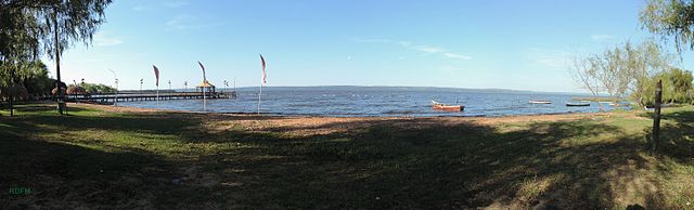
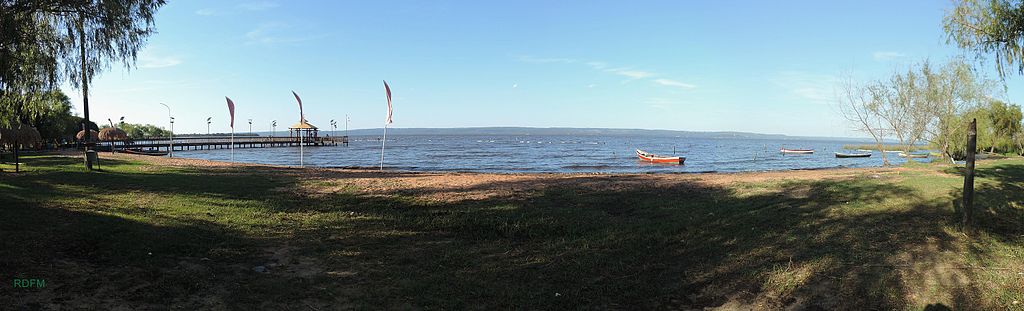
| Description | Lago Ypacarai | ||
| Date | Taken on 2 August 2014 | ||
| Source | https://web.archive.org/web/20161030202736/http://www.panoramio.com/photo/110009404 | ||
| Author | Rodney Damián | ||
| Permission (Reusing this file) |
This file is licensed under the Creative Commons Attribution-Share Alike 3.0 Unported license. Attribution: Rodney Damián
|
||
| Tags (from Panoramio photo page) | Areguá, 2014, Areguá, Central, Itauguá, Paraguay |
| Camera location | | View this and other nearby images on: OpenStreetMap |
|---|
.jpg¶ms=-25.302785_N_-057.373605_E_globe:Earth_type:camera_source:Panoramio_&language=en)
File history
Click on a date/time to view the file as it appeared at that time.
| Date/Time | Thumbnail | Dimensions | User | Comment | |
|---|---|---|---|---|---|
| current | 06:58, 10 April 2017 | 9,811 × 2,977 (2.84 MB) | Panoramio upload bot (talk | contribs) | == {{int:filedesc}} == {{Information |description=Lago Ypacarai |date={{Taken on|2014-08-02}} |source=http://www.panoramio.com/photo/110009404 |author=[http://www.panoramio.com/user/7668598?with_photo_id=110009404 Rodney Damián] |permission={{cc-by-sa... |
You cannot overwrite this file.
File usage on Commons
There are no pages that use this file.
File usage on other wikis
The following other wikis use this file:
- Usage on en.wikipedia.org
.jpg&oldid=840217159)