File:Lageplan-OpenStreet-IuW.PNG
Jump to navigation
Jump to search
Size of this preview: 800 × 491 pixels. Other resolutions: 320 × 196 pixels | 640 × 393 pixels | 899 × 552 pixels.
Original file (899 × 552 pixels, file size: 1,009 KB, MIME type: image/png)
Captions
Captions
Add a one-line explanation of what this file represents
Summary
[edit]
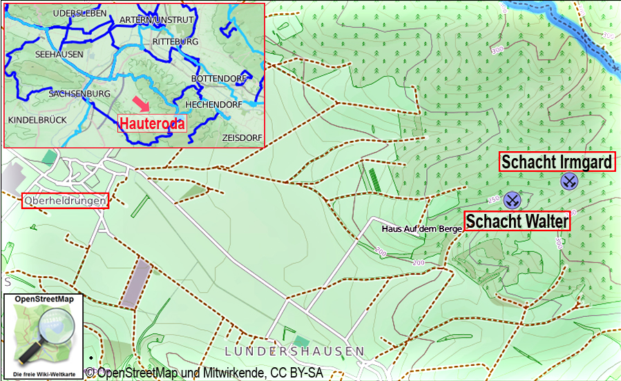
| Description | Lage der ehemaligen Kaliwerke der Gewerkschaften Walter und Irmgard |
| Date | |
| Source | OpenStreetMap |
| Author | Dr. Günter Pinzke |
| Other versions |
 |
Licensing
[edit]
I, the copyright holder of this work, hereby publish it under the following license:
This file is licensed under the Creative Commons Attribution-Share Alike 3.0 Unported license.
- You are free:
- to share – to copy, distribute and transmit the work
- to remix – to adapt the work
- Under the following conditions:
- attribution – You must give appropriate credit, provide a link to the license, and indicate if changes were made. You may do so in any reasonable manner, but not in any way that suggests the licensor endorses you or your use.
- share alike – If you remix, transform, or build upon the material, you must distribute your contributions under the same or compatible license as the original.
File history
Click on a date/time to view the file as it appeared at that time.
| Date/Time | Thumbnail | Dimensions | User | Comment | |
|---|---|---|---|---|---|
| current | 13:08, 8 September 2019 | | 899 × 552 (1,009 KB) | ديفيد عادل وهبة خليل 2 (talk | contribs) | == {{int:filedesc}} == {{Information |Description=Lage der ehemaligen Kaliwerke der Gewerkschaften Walter und Irmgard |Source=OpenStreetMap |Date=2012 |Author=Dr. Günter Pinzke |Permission= |other_versions=thumb|jpg }} Category:Historical mines in Thuringia Category:Maps of salt mines in Kyffhäuserkreis == {{int:license-header}} == {{self|cc-by-sa-3.0}} |
You cannot overwrite this file.
File usage on Commons
The following page uses this file: