File:Lagekarte Neuburger Wald.png
Jump to navigation
Jump to search
Size of this preview: 766 × 599 pixels. Other resolutions: 307 × 240 pixels | 613 × 480 pixels | 981 × 768 pixels | 1,280 × 1,002 pixels | 1,495 × 1,170 pixels.
Original file (1,495 × 1,170 pixels, file size: 979 KB, MIME type: image/png)
Captions
Captions
Add a one-line explanation of what this file represents
| Description |
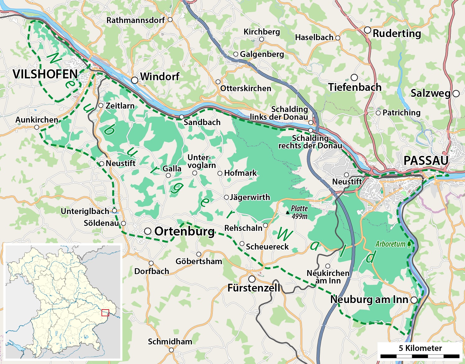
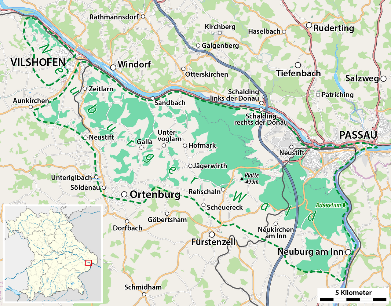
Deutsch: Lagekarte Neuburger Wald |
| Date | see file history |
| Source |
own work, using
|
| Author | Maximilian Dörrbecker (Chumwa) |
| Permission (Reusing this file) |
All OpenStreetMap data and maps are Creative Commons "CC-BY-SA 2.0" licensed This file is licensed under the Creative Commons Attribution-Share Alike 2.0 Generic license.
|
File history
Click on a date/time to view the file as it appeared at that time.
| Date/Time | Thumbnail | Dimensions | User | Comment | |
|---|---|---|---|---|---|
| current | 15:28, 23 August 2015 | | 1,495 × 1,170 (979 KB) | Chumwa (talk | contribs) | diverse Überarbeitungen |
| 21:17, 14 July 2009 |  | 1,495 × 1,170 (971 KB) | Chumwa (talk | contribs) | Untergniglbach -> Unteriglbach | |
| 06:54, 12 July 2009 |  | 1,495 × 1,170 (971 KB) | Chumwa (talk | contribs) | Platte hinzugefügt | |
| 06:51, 12 July 2009 |  | 1,495 × 1,170 (971 KB) | Chumwa (talk | contribs) | Platte hinzugefügt | |
| 06:19, 11 July 2009 |  | 1,495 × 1,170 (971 KB) | Chumwa (talk | contribs) | Lagehinweis in der Orientierungskarte war verrutscht | |
| 06:05, 11 July 2009 |  | 1,495 × 1,170 (970 KB) | Chumwa (talk | contribs) | {{Information |Description={{de|Lagekarte Neuburger Wald}} |Author=Maximilian Dörrbecker (Chumwa) |Source=own work, using * OpenStreetMap data for the background * this map by |
You cannot overwrite this file.
File usage on Commons
The following page uses this file:
File usage on other wikis
The following other wikis use this file:
- Usage on de.wikipedia.org
- Usage on uk.wikipedia.org
- Usage on www.wikidata.org