File:Lage des Landkreises Schwaebisch Hall in Deutschland.png
Jump to navigation
Jump to search
No higher resolution available.
Lage_des_Landkreises_Schwaebisch_Hall_in_Deutschland.png (197 × 235 pixels, file size: 4 KB, MIME type: image/png)
Captions
Captions
Add a one-line explanation of what this file represents
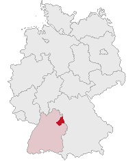
| Description | Landkreis Schwäbisch Hall, Baden-Württemberg, Germany | ||||||||
| Date | |||||||||
| Source | Own work | ||||||||
| Author | own work by Geograv | ||||||||
| Permission (Reusing this file) |
|

File history
Click on a date/time to view the file as it appeared at that time.
| Date/Time | Thumbnail | Dimensions | User | Comment | |
|---|---|---|---|---|---|
| current | 19:20, 26 October 2008 | | 197 × 235 (4 KB) | Rauenstein (talk | contribs) | |
| 19:38, 3 June 2007 | No thumbnail | 197 × 235 (4 KB) | Rauenstein (talk | contribs) | {{Information |Description=Landkreis Schwäbisch Hall, Baden-Württemberg, Germany |Source=self |Date=2007-06-03 |Author=own work by Geograv |Permission= {{GFDL}} }} [[Category:Locator maps of d |
You cannot overwrite this file.
File usage on Commons
There are no pages that use this file.
File usage on other wikis
The following other wikis use this file:
- Usage on eo.wikipedia.org
- Usage on fr.wikipedia.org
- Usage on id.wikipedia.org
- Usage on ja.wikipedia.org
- シュヴェービッシュ・ハル
- シュヴェービッシュ・ハル郡
- シュロツベルク
- ブラウフェルデン
- ランゲンブルク
- ゲーラブロン
- ロート・アム・ゼー
- ヴァルハウゼン (ヴュルテンベルク)
- キルヒベルク・アン・デア・ヤクスト
- ザッテルドルフ
- クライルスハイム
- クレスベルク
- フィヒテナウ
- シュティムプファッハ
- フランケンハルト
- フェルベルク
- イルスホーフェン
- ヴォルパーツハウゼン
- ブラウンスバッハ
- ウンターミュンクハイム
- ミヒェルフェルト
- ローゼンガルテン (シュヴェービッシュ・ハル郡)
- ミヒェルバッハ・アン・デア・ビルツ
- オーバーゾントハイム
- ビューラータン
- ビューラーツェル
- ズルツバッハ=ラウフェン
- ガイルドルフ
- フィヒテンベルク
- オーバーロート (バーデン=ヴュルテンベルク)
- マインハルト (バーデン=ヴュルテンベルク)
- Usage on ka.wikipedia.org
- Usage on lmo.wikipedia.org
- Usage on pl.wikipedia.org
- Usage on pt.wikipedia.org
- Usage on sk.wikipedia.org
- Usage on sv.wikipedia.org