File:Lage des Landkreises Bayreuth in Deutschland.png
Jump to navigation
Jump to search
No higher resolution available.
Lage_des_Landkreises_Bayreuth_in_Deutschland.png (197 × 235 pixels, file size: 3 KB, MIME type: image/png)
Captions
Captions
Add a one-line explanation of what this file represents
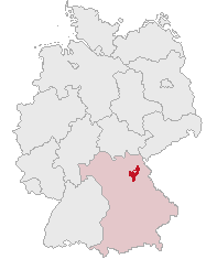
| Description | Landkreis Bayreuth, Bavaria, Germany | ||||||||
| Date | |||||||||
| Source | Own work | ||||||||
| Author | own work by Geograv | ||||||||
| Permission (Reusing this file) |
|

File history
Click on a date/time to view the file as it appeared at that time.
| Date/Time | Thumbnail | Dimensions | User | Comment | |
|---|---|---|---|---|---|
| current | 23:14, 28 May 2008 | | 197 × 235 (3 KB) | Rauenstein (talk | contribs) | {{Information |Description=Landkreis Bayreuth, Bavaria, Germany |Source=self |Date=2008-05-29 |Author=own work by Geograv |Permission= {{GFDL}} }} Bayreuth [[Ca |
You cannot overwrite this file.
File usage on Commons
There are no pages that use this file.
File usage on other wikis
The following other wikis use this file:
- Usage on da.wikipedia.org
- Usage on de.wikipedia.org
- Usage on fr.wikipedia.org
- Usage on ja.wikipedia.org
- バイロイト郡
- メールマイゼル
- フィヒテルベルク (オーバーフランケン)
- ヴァルメンシュタイナハ
- ビショフスグリュン
- ゲフレース
- バート・ベルネック・イム・フィヒテルゲビルゲ
- ゴルトクローナハ
- ビントラハ
- ハイナースロイト
- エッカースドルフ
- ミステルバッハ (オーバーフランケン)
- ゲゼース
- フンメルタール
- グラースヒュッテン (オーバーフランケン)
- ミステルガウ
- プランケンフェルス
- ホルフェルト
- アウフゼス
- ヴァイシェンフェルト
- アホルンタール
- ポッテンシュタイン (オーバーフランケン)
- ベッツェンシュタイン
- プレヒ
- ペグニッツ
- シュナーベルヴァイト
- プレビッツ
- ハーク (オーバーフランケン)
- クロイセン
- エムトマンスベルク
- ザイボーテンロイト
- ヴァイデンベルク
- キルヒェンピンガルテン
- シュパイヒャースドルフ
- Usage on pl.wikipedia.org