File:Lage des Donnersbergkreises in Deutschland.png
Jump to navigation
Jump to search
No higher resolution available.
Lage_des_Donnersbergkreises_in_Deutschland.png (197 × 235 pixels, file size: 3 KB, MIME type: image/png)
Captions
Captions
Add a one-line explanation of what this file represents
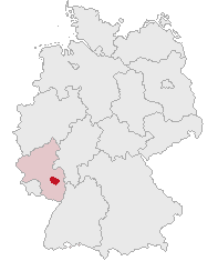
| Description | Donnersbergkreis, Rhineland-Palatinate, Germany | ||||||||
| Date | |||||||||
| Source | Own work | ||||||||
| Author | own work by Geograv | ||||||||
| Permission (Reusing this file) |
|

File history
Click on a date/time to view the file as it appeared at that time.
| Date/Time | Thumbnail | Dimensions | User | Comment | |
|---|---|---|---|---|---|
| current | 21:32, 5 June 2007 | | 197 × 235 (3 KB) | Rauenstein (talk | contribs) | |
| 08:53, 3 March 2006 |  | 176 × 234 (5 KB) | Rauenstein (talk | contribs) | Karte erstellt auf der Grundlage der opengeodb.de-Umrisse - GNU-FDL Geograv 13:12, 21. Mär 2005 {{Bild-GFDL}} |
You cannot overwrite this file.
File usage on Commons
There are no pages that use this file.
File usage on other wikis
The following other wikis use this file:
- Usage on eo.wikipedia.org
- Usage on fr.wikipedia.org
- Usage on fy.wikipedia.org
- Usage on it.wikipedia.org
- Usage on ka.wikipedia.org
- Usage on kk.wikipedia.org
- Usage on sv.wikipedia.org