File:Lage der einstigen Saline Staßfurt.jpg
Jump to navigation
Jump to search
Size of this preview: 766 × 600 pixels. Other resolutions: 307 × 240 pixels | 613 × 480 pixels | 981 × 768 pixels | 1,280 × 1,002 pixels | 2,222 × 1,740 pixels.
Original file (2,222 × 1,740 pixels, file size: 1.49 MB, MIME type: image/jpeg)
Captions
Captions
Add a one-line explanation of what this file represents
Summary
[edit]
| Description |
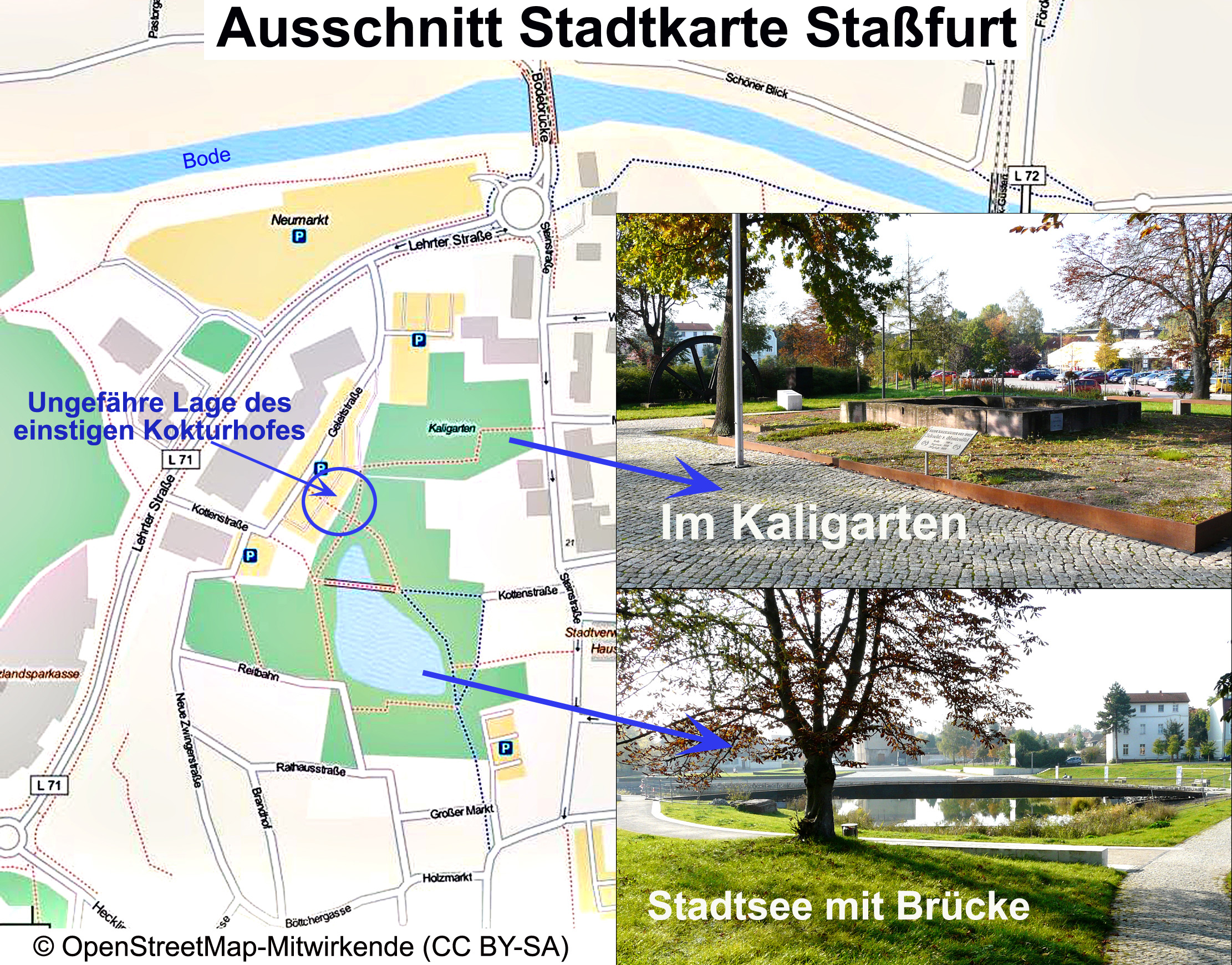
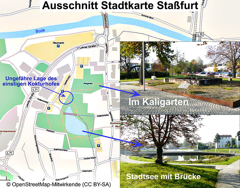
Deutsch: Ungefähre Lage des Salinegeländes der stillgelegten Saline Staßfurt. |
| Date | |
| Source | Karte: OpenStreetMap |
| Author | OpenStreetMap. Integrierte Fotos: Eigentümer Dr. Günter Pinzke. Recherche / Einzeichnung: Dr. Günter Pinzke |
| Permission (Reusing this file) |
Licensing
[edit]
| I, the copyright holder of this work, release this work into the public domain. This applies worldwide. In some countries this may not be legally possible; if so: I grant anyone the right to use this work for any purpose, without any conditions, unless such conditions are required by law. |
File history
Click on a date/time to view the file as it appeared at that time.
| Date/Time | Thumbnail | Dimensions | User | Comment | |
|---|---|---|---|---|---|
| current | 07:27, 11 September 2015 | | 2,222 × 1,740 (1.49 MB) | Berginspektor (talk | contribs) | {{Information |Description=Ungefähre Lage des Salinegeländes der stillgelegten Saline Staßfurt. |Source=OpenStreetMap<ref>http://www.openstreetmap.org/?lat=53.15&lon=12.3&zoom=8&layers=C</ref> |Date=2015 |Author=OpenStreetMap. Integrierte Fotos: Ein... |
You cannot overwrite this file.
File usage on Commons
There are no pages that use this file.
File usage on other wikis
The following other wikis use this file:
- Usage on de.wikipedia.org