File:Lage Scheunenviertel, 1862.png
Jump to navigation
Jump to search

Size of this preview: 800 × 543 pixels. Other resolutions: 320 × 217 pixels | 640 × 434 pixels | 1,047 × 710 pixels.
Original file (1,047 × 710 pixels, file size: 1.68 MB, MIME type: image/png)
Captions
Captions
Add a one-line explanation of what this file represents
Summary
[edit]
| Description |
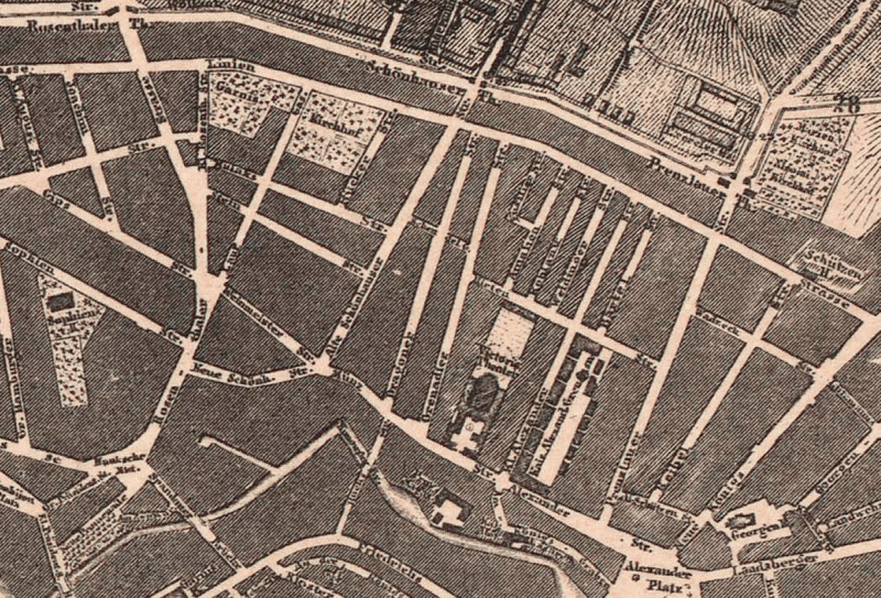
Deutsch: Lage des Scheunenviertels im nördlichen Teil Alt-Berlins. Aus: Übersichtskarte des Bebauungsplanes der Umgebungen Berlins. Der Bebauungsplan in Roth entworfen und vierfach ausgefertigt für das Kgl. Polizei-Präsidium, dem Magistrat von Charlottenburg. Berlin, den 25. April 1862. Oppermann, Regierungs- und Baurath. Gesehen und genehmigt: Berlin, 18. Juli 1862. |
| Date | |
| Source | Zentral- und Landesbibliothek Berlin |
| Author | Ferdinand Boehm (topografische Aufnahme, Kartografie), gestochen von W. Bembé (Ausschnitt) |
Licensing
[edit]
This media file is in the public domain in the United States. This applies to U.S. works where the copyright has expired, often because its first publication occurred prior to January 1, 1929, and if not then due to lack of notice or renewal. See this page for further explanation.
|
 | |
 |
File history
Click on a date/time to view the file as it appeared at that time.
| Date/Time | Thumbnail | Dimensions | User | Comment | |
|---|---|---|---|---|---|
| current | 16:57, 13 February 2015 | | 1,047 × 710 (1.68 MB) | WikiLink (talk | contribs) | User created page with UploadWizard |
You cannot overwrite this file.
File usage on Commons
There are no pages that use this file.
File usage on other wikis
The following other wikis use this file:
- Usage on de.wikipedia.org