File:Ladakh map.svg
Jump to navigation
Jump to search

Size of this PNG preview of this SVG file: 794 × 600 pixels. Other resolutions: 318 × 240 pixels | 635 × 480 pixels | 1,016 × 768 pixels | 1,280 × 967 pixels | 2,560 × 1,935 pixels | 1,588 × 1,200 pixels.
Original file (SVG file, nominally 1,588 × 1,200 pixels, file size: 512 KB)
Captions
Captions
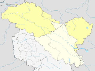
Map of the Union Territory of Ladakh, India

|
This file has been superseded by India Ladakh location map UN view.svg. It is recommended to use the other file. Please note that deleting superseded images requires consent.
|

|
Summary
[edit]
| Description |
English: Map of the Union Territory of Ladakh, India as of 2019. Includes Pakistan occupied Ladakh(Gilgit-Baltistan) and China/Chinese Occupied Ladakh(Aksai Chin and Shaksgam Valley). |
| Date | |
| Source | Own work |
| Author | Hindian1947 |
Licensing
[edit]
I, the copyright holder of this work, hereby publish it under the following license:
This file is licensed under the Creative Commons Attribution 3.0 Unported license.
- You are free:
- to share – to copy, distribute and transmit the work
- to remix – to adapt the work
- Under the following conditions:
- attribution – You must give appropriate credit, provide a link to the license, and indicate if changes were made. You may do so in any reasonable manner, but not in any way that suggests the licensor endorses you or your use.
File history
Click on a date/time to view the file as it appeared at that time.
| Date/Time | Thumbnail | Dimensions | User | Comment | |
|---|---|---|---|---|---|
| current | 02:57, 26 November 2019 | | 1,588 × 1,200 (512 KB) | Hindian1947 (talk | contribs) | Different colour for claimed territories |
| 03:43, 25 November 2019 |  | 1,588 × 1,200 (507 KB) | Hindian1947 (talk | contribs) | User created page with UploadWizard |
You cannot overwrite this file.
File usage on Commons
There are no pages that use this file.
File usage on other wikis
The following other wikis use this file: