File:La journée de Poltawa en Ukraine, le 8-e juillet 1709.jpg
Original file (3,000 × 2,009 pixels, file size: 1.86 MB, MIME type: image/jpeg)
Captions
Captions
Summary
[edit]| Description |
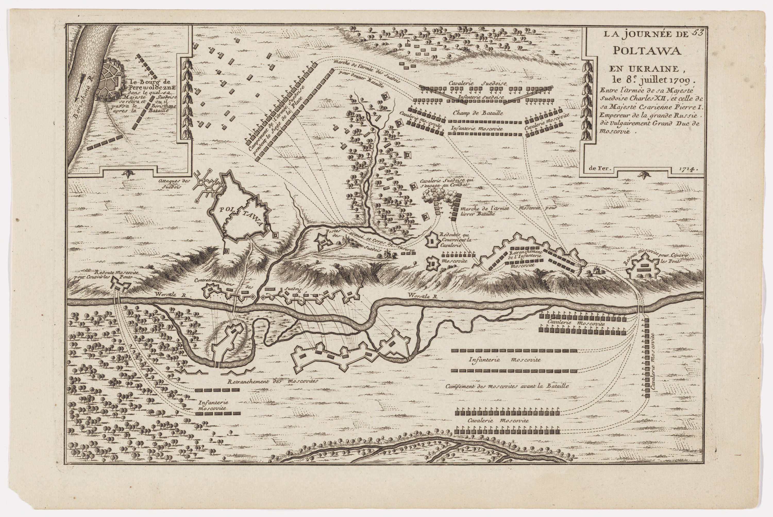
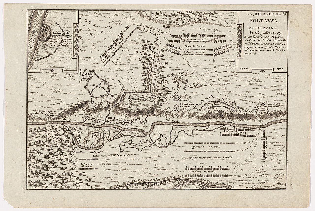
English: A map of battle of Poltava (1709) created by Nicolas de Fer, published in Paris (France) in 1714.
Full title is "La journée de Poltawa en Ukraine, le 8-e juillet 1709, entre sa Majesté suédoise Charles XII. et sa Majesté Csarienne Pierre I., Empereur de la Grande Russie, dit vulgairement Grand Duc de Moscovie". Relief shown pictorially. Inset shows the town of "Perewoloczna" [Perevolochna, Ukraine] where Charles XII, the King of Sweden withdrew after the battle. Appears in N. de Fer's Atlas curieux. In upper right corner of the vignette "53". Available also as a digital image through the Harvard University Library Web site. Electronic reproduction. Cambridge, Mass. : Harvard College Library Digital Imaging Group, 2008. Harvard Map Collection digital maps. Ukraine. |
||||||||||||||||||||
| Date | |||||||||||||||||||||
| Source | Harvard Library | ||||||||||||||||||||
| Author |
|
||||||||||||||||||||

Licensing
[edit]
|
This work is in the public domain in its country of origin and other countries and areas where the copyright term is the author's life plus 70 years or fewer. This work is in the public domain in the United States because it was published (or registered with the U.S. Copyright Office) before January 1, 1929. | |
| This file has been identified as being free of known restrictions under copyright law, including all related and neighboring rights. | |
File history
Click on a date/time to view the file as it appeared at that time.
| Date/Time | Thumbnail | Dimensions | User | Comment | |
|---|---|---|---|---|---|
| current | 13:30, 28 March 2020 | | 3,000 × 2,009 (1.86 MB) | ZxcvU (talk | contribs) | Uploaded a work by {{creator|wikidata=Q1648130}} from [https://curiosity.lib.harvard.edu/scanned-maps/catalog/44-990114462090203941 Harvard Library] with UploadWizard |
You cannot overwrite this file.
File usage on Commons
The following page uses this file: