File:La colonne de la Victoire (Berlin) (9637670827).jpg
Jump to navigation
Jump to search

Size of this preview: 400 × 600 pixels. Other resolutions: 160 × 240 pixels | 320 × 480 pixels | 683 × 1,024 pixels.
Original file (683 × 1,024 pixels, file size: 697 KB, MIME type: image/jpeg)
Captions
Captions
Add a one-line explanation of what this file represents
Summary
[edit]_(9637670827).jpg&action=edit§ion=1)
| Description |
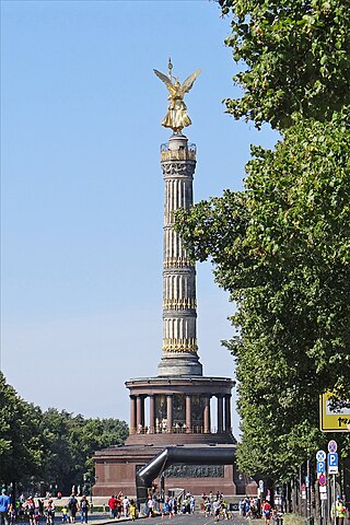
Siegessäule / Victory Column La colonne de la Victoire a été conçue par Grosser Stern et Johann Heinrich Strack en 1873. Elle a d'abord été érigée devant le Reichstag en commémoration de la victoire de l'Allemagne sur la France. Au sommet de la colonne se trouve la déesse de la Victoire, réalisée par Friedrich Drake et recouverte d'or. La colonne a été déplacée dans le Tiergarten à l'époque du national-socialisme. |
| Date | |
| Source | La colonne de la Victoire (Berlin) |
| Author | Jean-Pierre Dalbéra from Paris, France |
| Camera location | | View this and other nearby images on: OpenStreetMap |
|---|
_(9637670827).jpg¶ms=052.514601_N_0013.349976_E_globe:Earth_type:camera_source:Flickr_&language=en)
Licensing
[edit]_(9637670827).jpg&action=edit§ion=2)
This file is licensed under the Creative Commons Attribution 2.0 Generic license.
- You are free:
- to share – to copy, distribute and transmit the work
- to remix – to adapt the work
- Under the following conditions:
- attribution – You must give appropriate credit, provide a link to the license, and indicate if changes were made. You may do so in any reasonable manner, but not in any way that suggests the licensor endorses you or your use.
| This image was originally posted to Flickr by dalbera at https://flickr.com/photos/72746018@N00/9637670827 (archive). It was reviewed on 19 October 2019 by FlickreviewR 2 and was confirmed to be licensed under the terms of the cc-by-2.0. |
File history
Click on a date/time to view the file as it appeared at that time.
| Date/Time | Thumbnail | Dimensions | User | Comment | |
|---|---|---|---|---|---|
| current | 20:55, 19 October 2019 | | 683 × 1,024 (697 KB) | B2Belgium (talk | contribs) | Transferred from Flickr via #flickr2commons |
You cannot overwrite this file.
File usage on Commons
There are no pages that use this file.
_(9637670827).jpg&oldid=719190620)