File:La Tabaterie.jpg
Jump to navigation
Jump to search

Size of this preview: 800 × 600 pixels. Other resolutions: 320 × 240 pixels | 640 × 480 pixels | 1,024 × 768 pixels | 1,280 × 960 pixels | 2,560 × 1,920 pixels | 3,648 × 2,736 pixels.
Original file (3,648 × 2,736 pixels, file size: 1.68 MB, MIME type: image/jpeg)
Captions
Captions
Add a one-line explanation of what this file represents
Summary
[edit]
| Description |
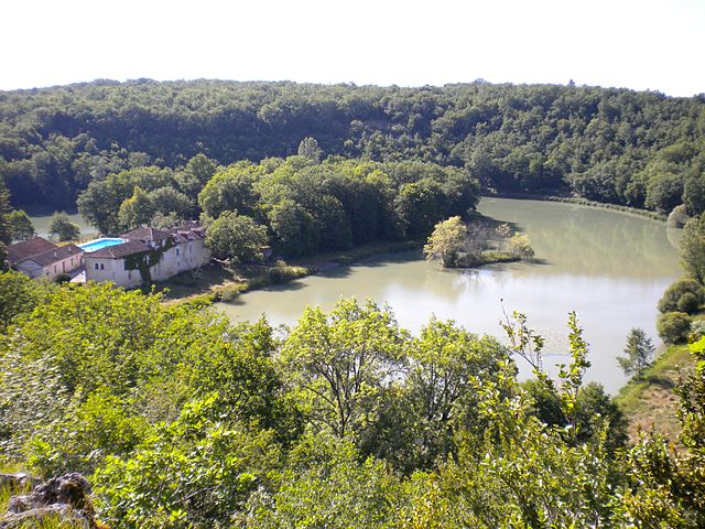
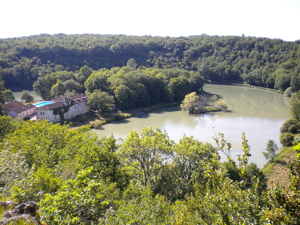
English: La Tabaterie, a hamlet in the commune of La Gonterie-Boulouneix, Dordogne, France. Here one of the meanders of the Boulou River was dammed to now form a horseshoe-shaped lake. The photo is taken from above (near the iron-age hillfort Roc Plat to the east).
Deutsch: La Tabaterie, ein zur Gemeinde von La Gonterie-Boulouneix (Dordogne, Frankreich) gehörendes Gehöft im Bouloutal. Der Fluss wurde hier aufgestaut, do dass jetzt ein hufeisenförmiger See eine Meanderschleife ausfüllt. Das Photo wurde in der Nähe des höherliegenden eisenzeitlichen Oppidums Roc Plat aus aufgenommen, Blickrichtung nach Westen.
Français : La Tabaterie, La Gonterie-Boulouneix, Dordogne, France. Ici le Boulou est endigué ainsi formant un lac semi-circulaire dans un méandre de la rivière. La photo fut prise près de l'oppidum Roc Plat situé en hauteur plus à l'est - vestiges datant de l'âge du fer. |
| Date | |
| Source | Own work |
| Author | Rudolf Pohl |
Licensing
[edit]
I, the copyright holder of this work, hereby publish it under the following licenses:
This file is licensed under the Creative Commons Attribution-Share Alike 3.0 Unported license.
- You are free:
- to share – to copy, distribute and transmit the work
- to remix – to adapt the work
- Under the following conditions:
- attribution – You must give appropriate credit, provide a link to the license, and indicate if changes were made. You may do so in any reasonable manner, but not in any way that suggests the licensor endorses you or your use.
- share alike – If you remix, transform, or build upon the material, you must distribute your contributions under the same or compatible license as the original.

|
Permission is granted to copy, distribute and/or modify this document under the terms of the GNU Free Documentation License, Version 1.2 or any later version published by the Free Software Foundation; with no Invariant Sections, no Front-Cover Texts, and no Back-Cover Texts. A copy of the license is included in the section entitled GNU Free Documentation License. |
You may select the license of your choice.
File history
Click on a date/time to view the file as it appeared at that time.
| Date/Time | Thumbnail | Dimensions | User | Comment | |
|---|---|---|---|---|---|
| current | 18:53, 25 June 2010 | | 3,648 × 2,736 (1.68 MB) | Rudolf Pohl (talk | contribs) | {{Information |Description={{en|1=La Tabaterie, a hamlet in the commune of La Gonterie-Boulouneix, Dordogne, France. Here one of the meanders of the Boulou River was dammed to now form a horseshoe-shaped lake. The photo is taken from above (near the iron- |
You cannot overwrite this file.
File usage on Commons
There are no pages that use this file.
File usage on other wikis
The following other wikis use this file:
- Usage on de.wikipedia.org
- Usage on fr.wikipedia.org
- Usage on ru.wikipedia.org