File:La Gola.jpg
From Wikimedia Commons, the free media repository
Jump to navigation
Jump to search
Size of this preview: 800 × 451 pixels. Other resolutions: 320 × 181 pixels | 640 × 361 pixels | 1,024 × 578 pixels | 1,280 × 722 pixels | 2,560 × 1,444 pixels | 3,648 × 2,058 pixels.
Original file (3,648 × 2,058 pixels, file size: 2.1 MB, MIME type: image/jpeg)
File information
Structured data
Captions
Summary
[edit]DescriptionLa Gola.jpg |
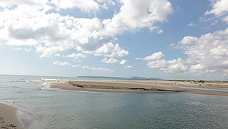
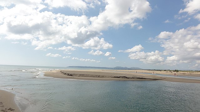
Català: Platja de Sant Pere Pescador
|
||
Date | |||
Source | Own work | ||
Author | Isidro Jabato | ||
Permission (Reusing this file) |
I, the copyright holder of this work, hereby publish it under the following license: This file is licensed under the Creative Commons Attribution-Share Alike 4.0 International license.
|
Camera location | 42° 12′ 07.12″ N, 3° 06′ 39.1″ E | View this and other nearby images on: OpenStreetMap | 42.201978; 3.110861 |
---|
File history
Click on a date/time to view the file as it appeared at that time.
Date/Time | Thumbnail | Dimensions | User | Comment | |
---|---|---|---|---|---|
current | 16:17, 31 May 2016 | 3,648 × 2,058 (2.1 MB) | Isidro Jabato (talk | contribs) | User created page with UploadWizard |
You cannot overwrite this file.
File usage on Commons
The following page uses this file:
File usage on other wikis
The following other wikis use this file:
- Usage on ca.wikipedia.org
- Usage on ceb.wikipedia.org
- Usage on www.wikidata.org
Metadata
This file contains additional information such as Exif metadata which may have been added by the digital camera, scanner, or software program used to create or digitize it. If the file has been modified from its original state, some details such as the timestamp may not fully reflect those of the original file. The timestamp is only as accurate as the clock in the camera, and it may be completely wrong.
Camera manufacturer | SONY |
---|---|
Camera model | DSC-HX5V |
Exposure time | 1/400 sec (0.0025) |
F-number | f/8 |
ISO speed rating | 125 |
Date and time of data generation | 10:28, 29 May 2016 |
Lens focal length | 4.25 mm |
Latitude | 42° 12′ 7.12″ N |
Longitude | 3° 6′ 39.1″ E |
Altitude | 8.1 meters below sea level |
Orientation | Normal |
File change date and time | 10:28, 29 May 2016 |
Y and C positioning | Co-sited |
Exposure Program | Normal program |
Exif version | 2.21 |
Date and time of digitizing | 10:28, 29 May 2016 |
Meaning of each component |
|
Image compression mode | 4 |
APEX exposure bias | 0 |
Maximum land aperture | 3.625 APEX (f/3.51) |
Metering mode | Pattern |
Light source | Unknown |
Flash | Flash did not fire, compulsory flash suppression |
DateTimeOriginal subseconds | 00 |
DateTimeDigitized subseconds | 00 |
Supported Flashpix version | 1 |
Color space | sRGB |
File source | Digital still camera |
Scene type | A directly photographed image |
Custom image processing | Normal process |
Exposure mode | Auto exposure |
White balance | Auto white balance |
Scene capture type | Standard |
Contrast | Normal |
Saturation | Normal |
Sharpness | Normal |
GPS time (atomic clock) | 08:28 |
Receiver status | Measurement interoperability |
Measurement mode | 3-dimensional measurement |
Speed unit | Kilometers per hour |
Speed of GPS receiver | 1 |
Reference for direction of movement | True direction |
Direction of movement | 215.82 |
Reference for direction of image | Magnetic direction |
Direction of image | 171.25 |
Geodetic survey data used | WGS-84 |
GPS date | 29 May 2016 |
GPS differential correction | 0 |
GPS tag version | 2.2.0.0 |