File:LUNA PARK,EMBLEMATICO ESTADIO CERRADO DE BUENOS AIRES.jpg
Jump to navigation
Jump to search

Size of this preview: 800 × 449 pixels. Other resolutions: 320 × 180 pixels | 640 × 359 pixels | 1,024 × 575 pixels | 1,280 × 718 pixels | 2,048 × 1,149 pixels.
Original file (2,048 × 1,149 pixels, file size: 254 KB, MIME type: image/jpeg)
Captions
Captions
Add a one-line explanation of what this file represents
Summary
[edit]
| Description |
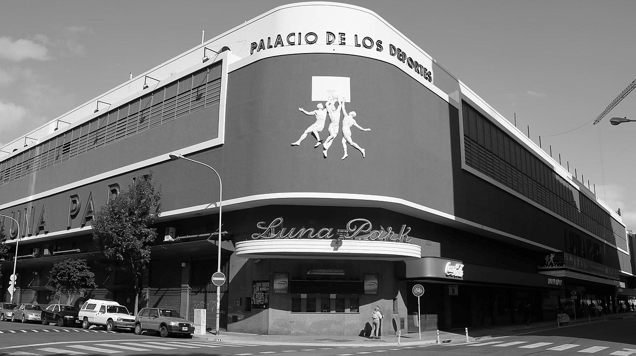
Español: El Luna Park es un tradicional estadio cubierto de Buenos Aires donde se realizan actividades artísticas y deportivas, fundado por Ismael Pace y José Lectoure en 1931. Este estadio ha sido testigo de varios de importantes acontecimientos en el siglo XX, encontrándose entre ellos actos religiosos, políticos, artísticos, deportivos y sociales. Se encuentra ubicado en la manzana delimitada por las calles Bouchard, Lavalle y las avenidas Eduardo Madero y la tradicional Corrientes.
|
||
| Date | |||
| Source | Own work | ||
| Author | Santiago Rodriguez Rivoira |
| Camera location | | View this and other nearby images on: OpenStreetMap |
|---|
Licensing
[edit]
I, the copyright holder of this work, hereby publish it under the following license:
This file is licensed under the Creative Commons Attribution-Share Alike 3.0 Unported license.
- You are free:
- to share – to copy, distribute and transmit the work
- to remix – to adapt the work
- Under the following conditions:
- attribution – You must give appropriate credit, provide a link to the license, and indicate if changes were made. You may do so in any reasonable manner, but not in any way that suggests the licensor endorses you or your use.
- share alike – If you remix, transform, or build upon the material, you must distribute your contributions under the same or compatible license as the original.

|
This image was uploaded as part of Wiki Loves Monuments 2013.
|
File history
Click on a date/time to view the file as it appeared at that time.
| Date/Time | Thumbnail | Dimensions | User | Comment | |
|---|---|---|---|---|---|
| current | 17:01, 4 September 2013 | | 2,048 × 1,149 (254 KB) | Santiago Rodriguez Rivoira (talk | contribs) | User created page with UploadWizard |
You cannot overwrite this file.
File usage on Commons
There are no pages that use this file.