File:LROC WAC Tycho crater stereo digital terrain model.png
Jump to navigation
Jump to search

Size of this preview: 600 × 600 pixels. Other resolutions: 240 × 240 pixels | 480 × 480 pixels | 768 × 768 pixels | 1,024 × 1,024 pixels | 1,300 × 1,300 pixels.
Original file (1,300 × 1,300 pixels, file size: 1.32 MB, MIME type: image/png)
Captions
Captions
Add a one-line explanation of what this file represents
| Description |
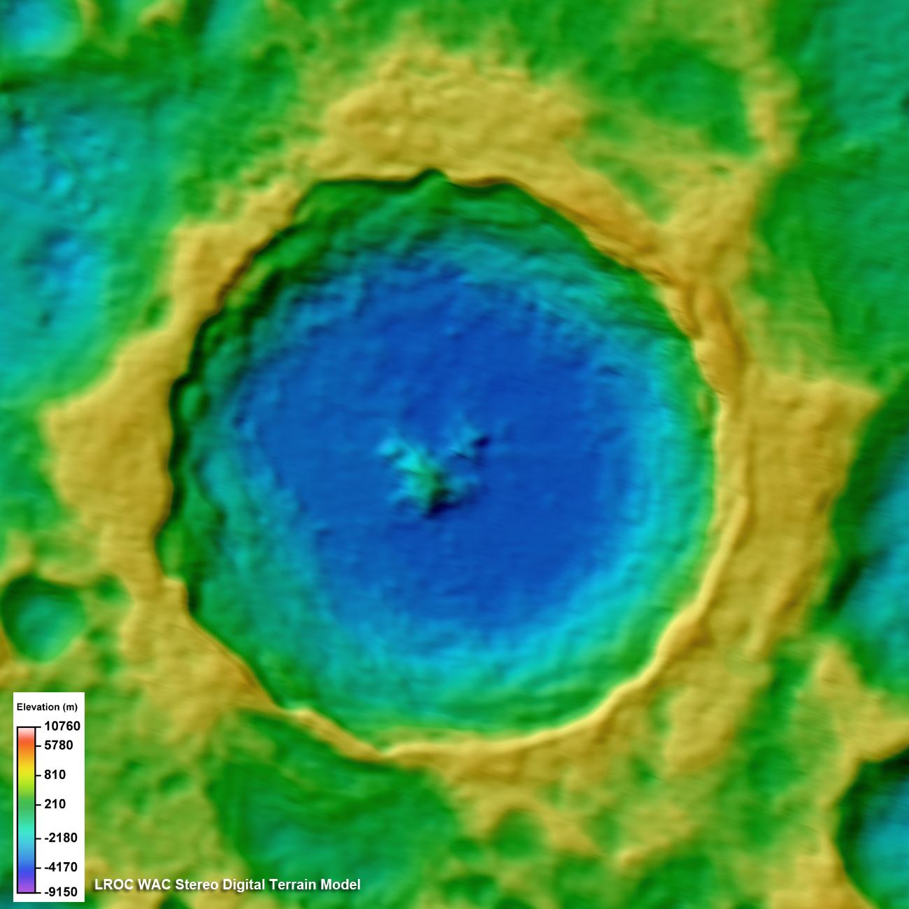
English: Topographic model of Tycho crater derived from LROC WAC stereo images, same area as shown in WAC mosaic [NASA/GSFC/Arizona State University]. |
|||||
| Date | ||||||
| Source | description, file | |||||
| Author | NASA/GSFC/Arizona State University | |||||
| Permission (Reusing this file) |
|
|||||
| Other versions |
 |

File history
Click on a date/time to view the file as it appeared at that time.
| Date/Time | Thumbnail | Dimensions | User | Comment | |
|---|---|---|---|---|---|
| current | 06:38, 8 September 2011 | | 1,300 × 1,300 (1.32 MB) | Badseed (talk | contribs) | {{Information |Description={{en|Topographic model of Tycho crater derived from LROC WAC stereo images, same area as shown in WAC mosaic above [NASA/GSFC/Arizona State University].}} |Source= [http://lroc.sese.asu.edu/news/index.php?/archives/411-Tycho-Cen |
You cannot overwrite this file.
File usage on Commons
The following 4 pages use this file:
.png)
.png)
File usage on other wikis
The following other wikis use this file:
- Usage on hy.wikipedia.org
- Usage on ru.wikipedia.org