File:LMS Duke of York (1935).jpg
LMS_Duke_of_York_(1935).jpg (454 × 279 pixels, file size: 112 KB, MIME type: image/jpeg)
Captions
Captions
Summary
[edit]DescriptionLMS Duke of York (1935).jpg |
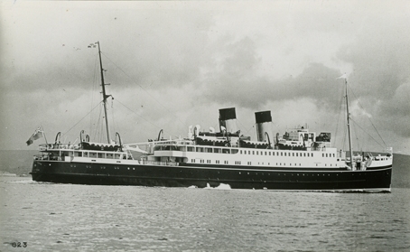
English: Fartyg: DUKE OF YORK
Rederi: London, Midland & Scottish Railway Byggår: 1935 Övrigt: Album 5, foto nr 110 |
Date | |
Source | https://digitaltmuseum.se/021015513996/823 |
Author | Unknown authorUnknown author |
Licensing
[edit]Public domainPublic domainfalsefalse |
![]() |
This UK artistic or literary work, of which the author is unknown and cannot be ascertained by reasonable enquiry, is in the public domain because it is one of the following:
|
![]() |
File history
Click on a date/time to view the file as it appeared at that time.
Date/Time | Thumbnail | Dimensions | User | Comment | |
---|---|---|---|---|---|
current | 14:18, 30 January 2024 | ![]() | 454 × 279 (112 KB) | Mr Mines Engine (talk | contribs) | Uploaded a work by {{Unknown|author}} from https://digitaltmuseum.se/021015513996/823 with UploadWizard |
You cannot overwrite this file.
File usage on Commons
The following page uses this file:
File usage on other wikis
The following other wikis use this file:
- Usage on de.wikipedia.org
- Usage on en.wikipedia.org
Metadata
This file contains additional information such as Exif metadata which may have been added by the digital camera, scanner, or software program used to create or digitize it. If the file has been modified from its original state, some details such as the timestamp may not fully reflect those of the original file. The timestamp is only as accurate as the clock in the camera, and it may be completely wrong.
Latitude | 0° 0′ 0″ N |
---|---|
Longitude | 0° 0′ 0″ E |
Altitude | 0 meters above sea level |
Orientation | Normal |
Horizontal resolution | 72 dpi |
Vertical resolution | 72 dpi |
Software used | Adobe Photoshop CS3 Windows |
File change date and time | 12:33, 4 March 2009 |
Y and C positioning | Centered |
Exif version | 2.21 |
Date and time of digitizing | 12:30, 4 March 2009 |
Meaning of each component |
|
Supported Flashpix version | 1 |
Color space | sRGB |
Scene capture type | Standard |
GPS time (atomic clock) | 00:00 |
Receiver status | |
Measurement mode | |
Measurement precision | Excellent (0) |
Speed unit | |
Speed of GPS receiver | 0 |
Reference for direction of movement | |
Direction of movement | 0 |
Reference for direction of image | |
Direction of image | 0 |
Latitude destination | 0° 0′ 0″ N |
Longitude of destination | 0° 0′ 0″ E |
Reference for bearing of destination | |
Bearing of destination | 0 |
Reference for distance to destination | |
Distance to destination | 0 |
GPS date | 4 March 2009 |
GPS tag version | 2.2.0.0 |
Image width | 454 px |
Image height | 279 px |
Date metadata was last modified | 13:33, 4 March 2009 |