File:LBL Wildfire Feb 28, 2016.jpg
Jump to navigation
Jump to search
Size of this preview: 800 × 450 pixels. Other resolutions: 320 × 180 pixels | 640 × 360 pixels | 1,024 × 577 pixels | 1,280 × 721 pixels | 3,552 × 2,000 pixels.
Original file (3,552 × 2,000 pixels, file size: 2.69 MB, MIME type: image/jpeg)
Captions
Captions
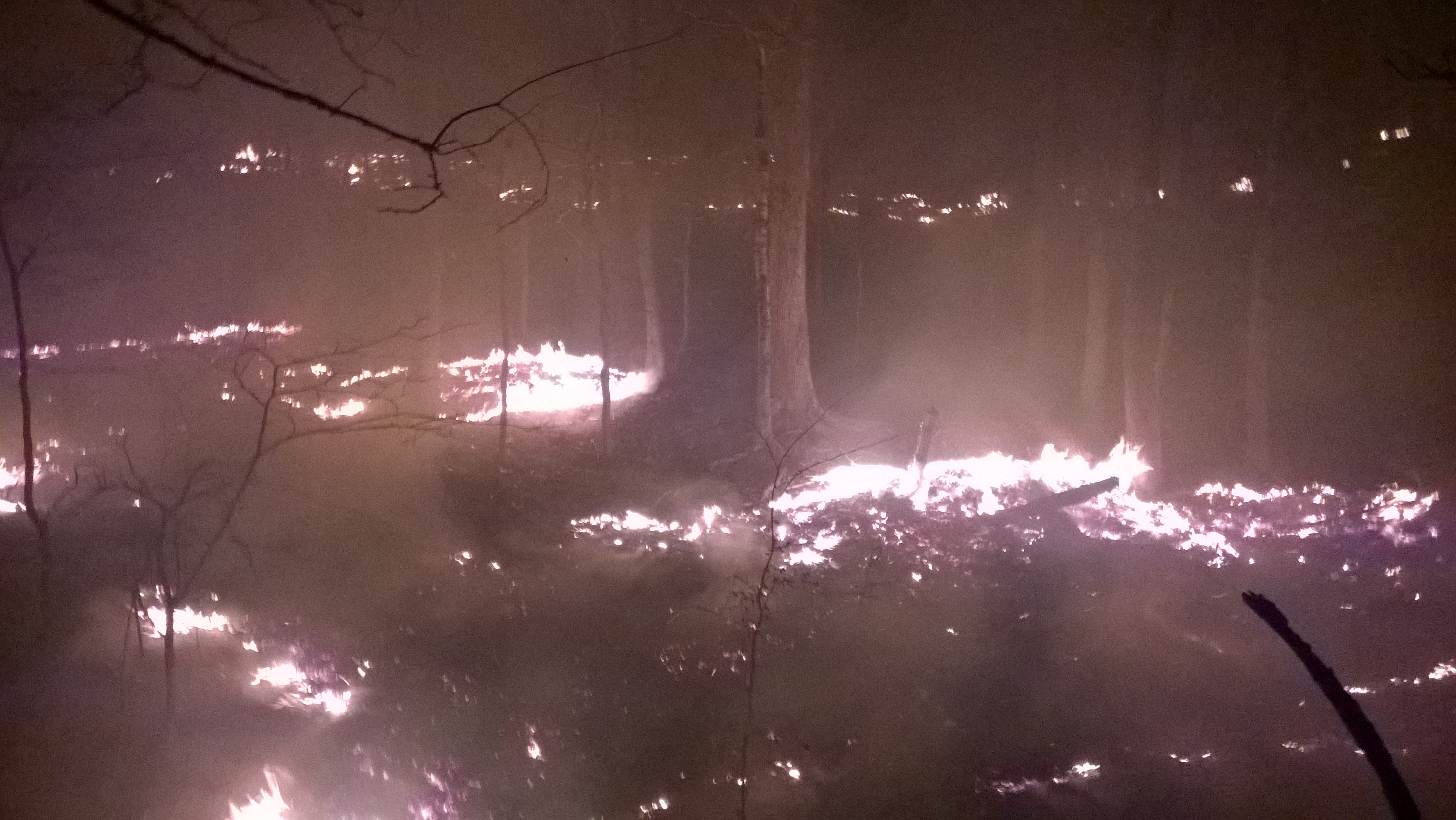
Wildfire at Land Between The Lakes, Kentucky, 2016
Summary
[edit]
| Description |
English: The wildfire that started early afternoon on Sunday, February 28, at Land Between The Lakes. The 911 call came in around 3pm directing emergency personnel to the forested area off Forest Service Road 120 in Lyon County, Ky. The U.S. Forest Service dispatched two fire engines along with available firefighters. Eddyville and Kuttawa firefighters also responded to the call. Working together, firefighters built a fire break which contained the wildfire to 43.8 acres using natural features and hand tools. The fire is currently 28.8 acres in size, with the interior showing minimal activity. The larger containment area allowed us to minimize impacts to cultural and natural resources. Staff photo |
| Date | |
| Source | https://www.flickr.com/photos/lblkytn/26229816161/ |
| Author | Land Between the Lakes KY/TN |
| Camera location | | View this and other nearby images on: OpenStreetMap |
|---|
Licensing
[edit]
| This image was originally posted to Flickr by LandBetweentheLakesKYTN at https://flickr.com/photos/82242140@N05/26229816161. It was reviewed on 20 October 2022 by FlickreviewR 2 and was confirmed to be licensed under the terms of the Public Domain Mark. |
This image is a work of the Forest Service of the United States Department of Agriculture. As a work of the U.S. federal government, the image is in the public domain.
|
File history
Click on a date/time to view the file as it appeared at that time.
| Date/Time | Thumbnail | Dimensions | User | Comment | |
|---|---|---|---|---|---|
| current | 01:01, 10 August 2022 | | 3,552 × 2,000 (2.69 MB) | Blythwood (talk | contribs) | Uploaded a work by Land Between the Lakes KY/TN from https://www.flickr.com/photos/lblkytn/26229816161/ with UploadWizard |
You cannot overwrite this file.
File usage on Commons
The following 2 pages use this file:
.jpg&redirect=no)
_(cropped).jpg)
File usage on other wikis
The following other wikis use this file:
- Usage on www.wikidata.org