File:L2 Sydney Light Rail diagram.png
Jump to navigation
Jump to search
Size of this preview: 404 × 599 pixels. Other resolutions: 162 × 240 pixels | 323 × 480 pixels | 517 × 768 pixels | 690 × 1,024 pixels | 1,380 × 2,048 pixels | 3,071 × 4,557 pixels.
Original file (3,071 × 4,557 pixels, file size: 623 KB, MIME type: image/png)
Captions
Captions
Add a one-line explanation of what this file represents
Summary
[edit]
| Description |
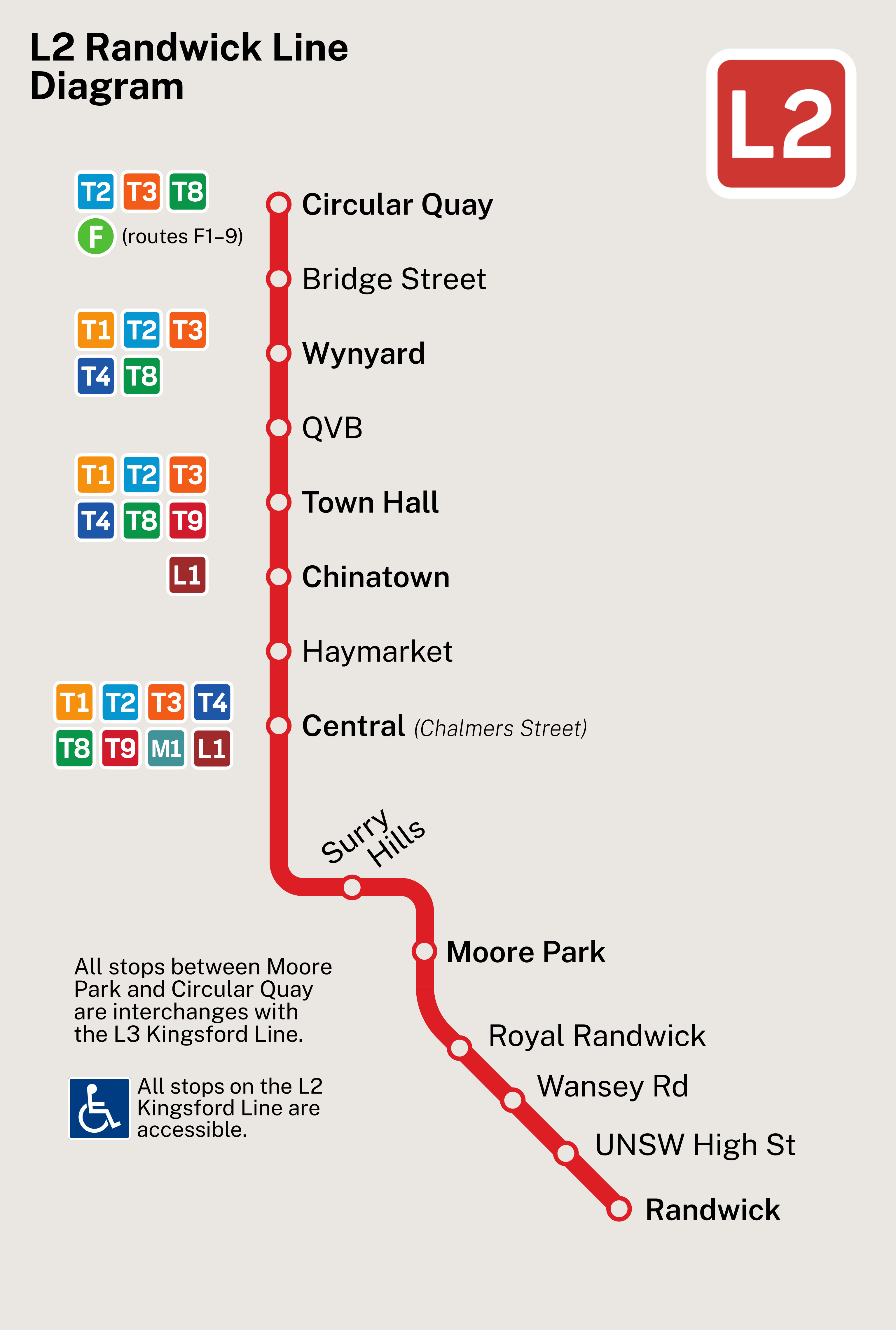
English: Map of L2 Randwick Line on the Sydney Light Rail network. |
| Date | |
| Source | Own work |
| Author | SHB2000 |
| Other versions | SVG file |
Licensing
[edit]
I, the copyright holder of this work, hereby publish it under the following license:
This file is licensed under the Creative Commons Attribution-Share Alike 4.0 International license.
- You are free:
- to share – to copy, distribute and transmit the work
- to remix – to adapt the work
- Under the following conditions:
- attribution – You must give appropriate credit, provide a link to the license, and indicate if changes were made. You may do so in any reasonable manner, but not in any way that suggests the licensor endorses you or your use.
- share alike – If you remix, transform, or build upon the material, you must distribute your contributions under the same or compatible license as the original.
This image has been assessed using the Quality image guidelines and is considered a Quality image.
|
File history
Click on a date/time to view the file as it appeared at that time.
| Date/Time | Thumbnail | Dimensions | User | Comment | |
|---|---|---|---|---|---|
| current | 11:04, 21 June 2024 | | 3,071 × 4,557 (623 KB) | SHB2000 (talk | contribs) | Uploaded own work with UploadWizard |
You cannot overwrite this file.
File usage on Commons
The following 7 pages use this file:
- User:Chumwa/OgreBot/Public transport information/2024 June 21-30
- User:Chumwa/OgreBot/Transport Maps/2024 June 21-30
- User:Chumwa/OgreBot/Travel and communication maps/2024 June 21-30
- User:SHB2000
- User talk:SHB2000/Archives/2024
- Commons:Quality images/Subject/Non photographic media
- Commons:Quality images candidates/Archives June 26 2024